Open Space in the Atlantic Yards Development
"A Garden of Eden grows in Brooklyn," announced the glossy brochure Brooklyn residents received in their mailboxes promoting the controversial Atlantic Yards development in Brooklyn. The brochure borrowed the words of former New York Times architecture critic Herbert Muschamp to promote developer Bruce Ratner's publicly subsidized mega-development slated to rise at the intersection of Atlantic and Flatbush avenues. In addition to building a Frank Gehry-designed basketball arena to bring the Nets to Brooklyn and 16 high-rises with up to 6,800 units of housing, the project promised open space and recreation for area with a severe shortage of parkland.
The Draft Environmental Impact Statement was released in July, giving the community its first chance to look closely at the details of a development that has skirted the usual public review process. Has the developer lived up to his promise for open space? Does the plan contain enough active and passive recreational space for the projected 15,000 or more new residents as well as the people who already live in the surrounding neighborhoods of Fort Greene, Clinton Hill, Boerum Hill, Prospect Heights, and Park Slope? Will the open space, set in between apartment towers, be truly public? And are there plans or mandates in place guaranteeing that the space's management, programming, and maintenance would make it accessible and inviting to the public?
What's There Now
No one disputes that the area surrounding the Atlantic Yards site has an acute lack of both active and passive open space.
The city's optimal goal for open space per thousand residents is 2.5 acres, of which 2 acres should be for active recreation. Anything less than 1.5 acres of open space per 1,000 residents is considered a deficiency of open space. At present, according the Draft Environmental Impact Statement's optimistic calculations of existing public space, there are just .36 acres of open space per 1,000 residents within a half-mile radius. Half of that acreage is for active recreation.
The amount of usable parkland is actually much lower than the statement indicates, however, because a third of the 23.79 acres it counts are mostly fenced-off greenery within the giant traffic circle known as Grand Army Plaza, one of the most treacherous intersections in Brooklyn. Another few acres are asphalt courts, or schoolyards and fields available for limited hours. The statement mentions other open spaces that it claims mitigate the shortage, such as community gardens, private plazas and public parks not officially within the area analyzed. These include Prospect Park, whose closest entrance is a good half-hour walk from the project site; heavily used Fort Greene Park; the exposed and unappealing plaza outside the Atlantic Terminal shopping mall; and even a few unshaded benches attached to planters at an entrance to the Atlantic Mall.
The Promised Parkland
Atlantic Yards includes seven acres of open space on top of a deck to be constructed over the Vanderbilt rail yards. The designer is Laurie Olin, the highly regarded landscape architect who designed Bryant Park and Battery Park City. All of the park space would be in the interior of two large blocks containing ten high-rise residential towers.
The open space plans include two playgrounds, a half basketball court, an active play area for bocce and volleyball, a large oval lawn, and trees, but no baseball or soccer fields. A curving walkway would continue the street grid through the middle of the space. There will be pools that hold water as part of the comprehensive storm water management plan.
In addition to the parkland, the project calls for an "Urban Room," a soaring lobby for the Nets arena that is to double as a community space. The developer originally promised a running track on the roof of the arena, but, said Forest City Ratner spokesman Joe DePlasco in an email, "We decided against sending the public to the roof for safety and design reasons, given how difficult it would be to provide access." Now, an acre of green rooftop is being reserved for private use by building tenants, which the environmental impact statement says will reduce the need for public open space.
On face value, the amount of open space is respectable. It constitutes almost a third of the project's 22-acre site. But because the towers would have so many residents -- with a projected 15,000 to 18,000 residents, it would become the densest census tract in the country -- the area within a half-mile radius would actually end up with a lower ratio of public space per resident that it has now, .28 acres per 1,000 residents. The percentage of active recreational space would drop to .15 acres. The already fully booked sports fields in Prospect Park and elsewhere in the area would not be able to absorb the overload.
Compare that to Battery Park City, which also has about a third of its 92 acres of residential and commercial development set aside as parks and fields. When completely built, it will have about 14,000 residents, so the ratio of parkland per 1,000 residents meets the city's goal of 2.5.
At Battery Park City, much of the parkland was put in before construction of the buildings. At Atlantic Yards, however, no parkland is slated to be constructed until the second building phase, which includes most of the residential towers, estimated to be completed in 2016. For families affected by a lack of places to play, ten years is most of a childhood. Also, the economic and real estate climate can change drastically over ten or more years. Changing financial circumstances could prevent the developer from finishing the green space as planned or create pressure to increase the footprint of the buildings.
In addition, according to the environmental statement, the multiple tall buildings will throw some of the existing public spaces into shadow and make them less likely to be used. Particularly affected will be the open space around the Atlantic Terminal Houses, which will get far less sunlight during the colder months. That would reduce the value of its open spaces for relaxation and recreation, and could affect the housing project's safety, because parks are much safer when people are using them.
The underlying assumption of the open space plan seems to be that it is acceptable for the developer to (eventually) keep the status quo, more or less. The environmental impact statement states, "It is recognized that [the city's minimum standards of parkland per capita] are goals that are not feasible in many parks of the city."
"Clearly the development requires more emphasis on open space and parks," said Christian DePalermo, executive director of the advocacy group New Yorkers for Parks. The group wants to see the amount of parkland increased and make it more accessible to the public. It is also lobbying for the creation of interim park space during the first phases of construction.
Public or Private Eden?
From the sketches available, the park space itself looks appealing. Yet it is surrounded and enclosed by tall buildings. Would it end up being used mostly by the residents of the towers? Would there be an invisible "keep out" sign, as in Stuyvesant Town or other apartment complexes with interior parks?
Forest City Ratner says that it has taken pains to create a publicly accessible space that invites the public in. "The entire space has been developed to create access for all, including sight lines that run through, open spaces, play spaces, walkways, and quiet places," said DePlasco. Entrances to the space have been designed so that the interior of the green space is visible from the sidewalks, and a tree- and bench-lined walkway continues Pacific Street through the larger of the two high-rise blocks. A southbound bicycle path would run through the project area.
Urban planning experts aren't convinced, however, that the design puts public access first. "A lot of the corridors are matched up with building entrances and areas that seem like outdoor lobbies," said Andy Wiley-Schwartz, vice-president at the Project for Public Spaces, a non-profit group that works to improve community life through public spaces. He is reviewing the open space part of the environmental impact statement as a consultant for the Council of Brooklyn Neighborhoods.
The Municipal Art Society, a nonprofit advocate for excellence in urban planning and design, conducted an eight-month analysis of Atlantic Yards. Regarding the open space component, it concluded that the parkland would serve primarily as a backyard for the residential skyscrapers. "Look at any successful park, and you'll see it's surrounded by streets," said Jasper Goldman, an advocacy associate at the society. "This is laying down buildings and then carving the park around it. We keep asking, 'Can you point to an example where a space configured like this functions as a public space?'" In concluding that the project in its present form does not work for Brooklyn, the society set forth five urban design principles by which the plan should be amended, including "Create a real public park."
Also important to consider is whether the rest of the development will have the scale and street life to attract pedestrians to the edges of the park. "Pedestrian movement is critical to the success of open space," said Wiley-Schwartz. Even now-before the addition of an arena, new stores and offices, and of more than 6,800 apartments-the site is a pedestrian's nightmare. Shoppers walking to its malls face a gauntlet of dangerous street crossings and a trek past blank walls on treeless sidewalks. Plans for the Atlantic Yards include planting street trees and providing retail space for bodegas and boutiques, the kinds of things that increase pedestrian traffic, but few details have been provided. "Who knows if that's going to happen?" said Wiley-Schwartz.
Another reason planning experts lack confidence in the park plans is developer Bruce Ratner's poor track record in this area. They argue that previous Brooklyn developments, including the Atlantic Mall and Metro Tech, have contributed almost nothing to public open space or a vibrant street life. "If your plan was to be public and provide open access, the project has the wrong combination of developer and architect," said Wiley-Schwartz. "You've got an architect who builds suit-of-armor buildings that repel people from their edges. The exterior of the Bilbao Musuem is famously unsafe. And you've got a developer who builds tower-moat projects."
It is also not clear whether the 10,000-square-foot "Urban Room" in the arena will function as intended. "It is being marketed as the Grand Central for Brooklyn, but it's configured like it's going to be a lobby to the arena," said Goldman. "Will it function as a public space given that?"
"We do hope people use the Urban Room to access activities at the arena," said Pelasco of Forest City Ratner. "But beyond that, we hope that it is a comfortable place to just sit, rest, and watch other people. There will be programming there as well, including music, art displays and other activities."
How Will It Be Managed?
Even more than its design, the way a park is managed is the most important factor in making a truly public space, according to planners. "That's true for any park anywhere," said Wiley-Schwartz. "If Bryant Park was as beautiful, but didn't have chairs, ice-skating, wi-fi, movies, and events, it wouldn't be the thriving open space that it is now."
To bring people into the Atlantic Yards park, said Wiley-Schwartz, its managers would need to create "events, destinations, and exciting things." But the interests of the residents would naturally tend to dominate the types of activities that would take place, he argued, effectively privatizing the space.
The proposed open space would not be public parkland; it would be owned by Forest City Ratner and be considered privately owned public space, like the so-called "bonus plazas" in midtown created in exchange for allowing the construction of taller buildings. Those spaces are governed by city law requiring they be properly maintained, identified, and open to the public, although the laws have not always been enforced.
"The only requirement we have is to create spaces that are inviting to all, and to ensure, to the extent possible, that they are safe," said Pelasco. "As with other spaces, these will close at night and there will be consideration for activities related to safety. But like Bryant Park and other public spaces that are part of residential areas, these will be open and alive while respectful of the people living nearby."
Neither the city nor the state appears to have set any requirements for maintenance or public access, or any enforcement mechanism.
Battery Park City offers a good example of how a large housing and commercial development can include parkland that is both a destination for visitors and an amenity for the neighborhood. There, most of the parkland is between the waterfront and the buildings. It is officially public parkland, although it is managed by a nonprofit conservancy and maintenance is funded largely by the residents of Battery Park City and its residential and commercial developers. Throughout the year, the conservancy offers activities ranging from classes for children to music festivals.
In the Atlantic Yards project, critics argue, the open space looks more like window dressing, something to make the huge towers more palatable to residents of tree-lined brownstone Brooklyn. They have concluded that the plan is woefully short on parkland, given the project's planned density and the privatizing design of the new open space. Counteracting good urban planning policy and design, critics argue, the development would actually worsen the existing deficiency of public open space, and overload the recreational infrastructure far beyond immediate area. It is also shortsighted from a purely economic viewpoint, they say, because well-maintained parks raise real estate values. Elected officials have lined up in support of the Atlantic Yards project, but they focus on the promise of affordable housing, jobs and a major-league sports team. What the officials forgot to notice, parks advocates argues, is that the emperor has hardly any parks.  Anne Schwartz, in charge of the parks topic page since its inception in 1999, is a journalist who specializes in environmental issues.Â
Open Space in the Atlantic Yards Development
"A Garden of Eden grows in Brooklyn," announced the glossy brochure Brooklyn residents received in their mailboxes promoting the controversial Atlantic Yards development in Brooklyn. The brochure borrowed the words of former New York Times architecture critic Herbert Muschamp to promote developer Bruce Ratner's publicly subsidized mega-development slated to rise at the intersection of Atlantic and Flatbush avenues. In addition to building a Frank Gehry-designed basketball arena to bring the Nets to Brooklyn and 16 high-rises with up to 6,800 units of housing, the project promised open space and recreation for area with a severe shortage of parkland.
The Draft Environmental Impact Statement was released in July, giving the community its first chance to look closely at the details of a development that has skirted the usual public review process. Has the developer lived up to his promise for open space? Does the plan contain enough active and passive recreational space for the projected 15,000 or more new residents as well as the people who already live in the surrounding neighborhoods of Fort Greene, Clinton Hill, Boerum Hill, Prospect Heights, and Park Slope? Will the open space, set in between apartment towers, be truly public? And are there plans or mandates in place guaranteeing that the space's management, programming, and maintenance would make it accessible and inviting to the public?
What's There Now
No one disputes that the area surrounding the Atlantic Yards site has an acute lack of both active and passive open space.
The city's optimal goal for open space per thousand residents is 2.5 acres, of which 2 acres should be for active recreation. Anything less than 1.5 acres of open space per 1,000 residents is considered a deficiency of open space. At present, according the Draft Environmental Impact Statement's optimistic calculations of existing public space, there are just .36 acres of open space per 1,000 residents within a half-mile radius. Half of that acreage is for active recreation.
The amount of usable parkland is actually much lower than the statement indicates, however, because a third of the 23.79 acres it counts are mostly fenced-off greenery within the giant traffic circle known as Grand Army Plaza, one of the most treacherous intersections in Brooklyn. Another few acres are asphalt courts, or schoolyards and fields available for limited hours. The statement mentions other open spaces that it claims mitigate the shortage, such as community gardens, private plazas and public parks not officially within the area analyzed. These include Prospect Park, whose closest entrance is a good half-hour walk from the project site; heavily used Fort Greene Park; the exposed and unappealing plaza outside the Atlantic Terminal shopping mall; and even a few unshaded benches attached to planters at an entrance to the Atlantic Mall.
The Promised Parkland
Atlantic Yards includes seven acres of open space on top of a deck to be constructed over the Vanderbilt rail yards. The designer is Laurie Olin, the highly regarded landscape architect who designed Bryant Park and Battery Park City. All of the park space would be in the interior of two large blocks containing ten high-rise residential towers.
The open space plans include two playgrounds, a half basketball court, an active play area for bocce and volleyball, a large oval lawn, and trees, but no baseball or soccer fields. A curving walkway would continue the street grid through the middle of the space. There will be pools that hold water as part of the comprehensive storm water management plan.
In addition to the parkland, the project calls for an "Urban Room," a soaring lobby for the Nets arena that is to double as a community space. The developer originally promised a running track on the roof of the arena, but, said Forest City Ratner spokesman Joe DePlasco in an email, "We decided against sending the public to the roof for safety and design reasons, given how difficult it would be to provide access." Now, an acre of green rooftop is being reserved for private use by building tenants, which the environmental impact statement says will reduce the need for public open space.
On face value, the amount of open space is respectable. It constitutes almost a third of the project's 22-acre site. But because the towers would have so many residents -- with a projected 15,000 to 18,000 residents, it would become the densest census tract in the country -- the area within a half-mile radius would actually end up with a lower ratio of public space per resident that it has now, .28 acres per 1,000 residents. The percentage of active recreational space would drop to .15 acres. The already fully booked sports fields in Prospect Park and elsewhere in the area would not be able to absorb the overload.
Compare that to Battery Park City, which also has about a third of its 92 acres of residential and commercial development set aside as parks and fields. When completely built, it will have about 14,000 residents, so the ratio of parkland per 1,000 residents meets the city's goal of 2.5.
At Battery Park City, much of the parkland was put in before construction of the buildings. At Atlantic Yards, however, no parkland is slated to be constructed until the second building phase, which includes most of the residential towers, estimated to be completed in 2016. For families affected by a lack of places to play, ten years is most of a childhood. Also, the economic and real estate climate can change drastically over ten or more years. Changing financial circumstances could prevent the developer from finishing the green space as planned or create pressure to increase the footprint of the buildings.
In addition, according to the environmental statement, the multiple tall buildings will throw some of the existing public spaces into shadow and make them less likely to be used. Particularly affected will be the open space around the Atlantic Terminal Houses, which will get far less sunlight during the colder months. That would reduce the value of its open spaces for relaxation and recreation, and could affect the housing project's safety, because parks are much safer when people are using them.
The underlying assumption of the open space plan seems to be that it is acceptable for the developer to (eventually) keep the status quo, more or less. The environmental impact statement states, "It is recognized that [the city's minimum standards of parkland per capita] are goals that are not feasible in many parks of the city."
"Clearly the development requires more emphasis on open space and parks," said Christian DePalermo, executive director of the advocacy group New Yorkers for Parks. The group wants to see the amount of parkland increased and make it more accessible to the public. It is also lobbying for the creation of interim park space during the first phases of construction.
Public or Private Eden?
From the sketches available, the park space itself looks appealing. Yet it is surrounded and enclosed by tall buildings. Would it end up being used mostly by the residents of the towers? Would there be an invisible "keep out" sign, as in Stuyvesant Town or other apartment complexes with interior parks?
Forest City Ratner says that it has taken pains to create a publicly accessible space that invites the public in. "The entire space has been developed to create access for all, including sight lines that run through, open spaces, play spaces, walkways, and quiet places," said DePlasco. Entrances to the space have been designed so that the interior of the green space is visible from the sidewalks, and a tree- and bench-lined walkway continues Pacific Street through the larger of the two high-rise blocks. A southbound bicycle path would run through the project area.
Urban planning experts aren't convinced, however, that the design puts public access first. "A lot of the corridors are matched up with building entrances and areas that seem like outdoor lobbies," said Andy Wiley-Schwartz, vice-president at the Project for Public Spaces, a non-profit group that works to improve community life through public spaces. He is reviewing the open space part of the environmental impact statement as a consultant for the Council of Brooklyn Neighborhoods.
The Municipal Art Society, a nonprofit advocate for excellence in urban planning and design, conducted an eight-month analysis of Atlantic Yards. Regarding the open space component, it concluded that the parkland would serve primarily as a backyard for the residential skyscrapers. "Look at any successful park, and you'll see it's surrounded by streets," said Jasper Goldman, an advocacy associate at the society. "This is laying down buildings and then carving the park around it. We keep asking, 'Can you point to an example where a space configured like this functions as a public space?'" In concluding that the project in its present form does not work for Brooklyn, the society set forth five urban design principles by which the plan should be amended, including "Create a real public park."
Also important to consider is whether the rest of the development will have the scale and street life to attract pedestrians to the edges of the park. "Pedestrian movement is critical to the success of open space," said Wiley-Schwartz. Even now-before the addition of an arena, new stores and offices, and of more than 6,800 apartments-the site is a pedestrian's nightmare. Shoppers walking to its malls face a gauntlet of dangerous street crossings and a trek past blank walls on treeless sidewalks. Plans for the Atlantic Yards include planting street trees and providing retail space for bodegas and boutiques, the kinds of things that increase pedestrian traffic, but few details have been provided. "Who knows if that's going to happen?" said Wiley-Schwartz.
Another reason planning experts lack confidence in the park plans is developer Bruce Ratner's poor track record in this area. They argue that previous Brooklyn developments, including the Atlantic Mall and Metro Tech, have contributed almost nothing to public open space or a vibrant street life. "If your plan was to be public and provide open access, the project has the wrong combination of developer and architect," said Wiley-Schwartz. "You've got an architect who builds suit-of-armor buildings that repel people from their edges. The exterior of the Bilbao Musuem is famously unsafe. And you've got a developer who builds tower-moat projects."
It is also not clear whether the 10,000-square-foot "Urban Room" in the arena will function as intended. "It is being marketed as the Grand Central for Brooklyn, but it's configured like it's going to be a lobby to the arena," said Goldman. "Will it function as a public space given that?"
"We do hope people use the Urban Room to access activities at the arena," said Pelasco of Forest City Ratner. "But beyond that, we hope that it is a comfortable place to just sit, rest, and watch other people. There will be programming there as well, including music, art displays and other activities."
How Will It Be Managed?
Even more than its design, the way a park is managed is the most important factor in making a truly public space, according to planners. "That's true for any park anywhere," said Wiley-Schwartz. "If Bryant Park was as beautiful, but didn't have chairs, ice-skating, wi-fi, movies, and events, it wouldn't be the thriving open space that it is now."
To bring people into the Atlantic Yards park, said Wiley-Schwartz, its managers would need to create "events, destinations, and exciting things." But the interests of the residents would naturally tend to dominate the types of activities that would take place, he argued, effectively privatizing the space.
The proposed open space would not be public parkland; it would be owned by Forest City Ratner and be considered privately owned public space, like the so-called "bonus plazas" in midtown created in exchange for allowing the construction of taller buildings. Those spaces are governed by city law requiring they be properly maintained, identified, and open to the public, although the laws have not always been enforced.
"The only requirement we have is to create spaces that are inviting to all, and to ensure, to the extent possible, that they are safe," said DePelasco. "As with other spaces, these will close at night and there will be consideration for activities related to safety. But like Bryant Park and other public spaces that are part of residential areas, these will be open and alive while respectful of the people living nearby."
Neither the city nor the state appears to have set any requirements for maintenance or public access, or any enforcement mechanism.
Battery Park City offers a good example of how a large housing and commercial development can include parkland that is both a destination for visitors and an amenity for the neighborhood. There, most of the parkland is between the waterfront and the buildings. It is officially public parkland, although it is managed by a nonprofit conservancy and maintenance is funded largely by the residents of Battery Park City and its residential and commercial developers. Throughout the year, the conservancy offers activities ranging from classes for children to music festivals.
In the Atlantic Yards project, critics argue, the open space looks more like window dressing, something to make the huge towers more palatable to residents of tree-lined brownstone Brooklyn. They have concluded that the plan is woefully short on parkland, given the project's planned density and the privatizing design of the new open space. Counteracting good urban planning policy and design, critics argue, the development would actually worsen the existing deficiency of public open space, and overload the recreational infrastructure far beyond immediate area. It is also shortsighted from a purely economic viewpoint, they say, because well-maintained parks raise real estate values. Elected officials have lined up in support of the Atlantic Yards project, but they focus on the promise of affordable housing, jobs and a major-league sports team. What the officials forgot to notice, parks advocates argues, is that the emperor has hardly any parks.  Anne Schwartz, in charge of the parks topic page since its inception in 1999, is a journalist who specializes in environmental issues.Â
Going Green: Three Parks Face The Future
Tradition vs. Renovation in Washington Square
By Shoshana Schwartz
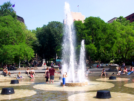
Many of the people who use Washington Square Park every day gravitate to a favorite section. For Wayne Monz, it is the chess area, where former world chess champion Bobby Fischer played. For high school student Rachel Sears, it is the lawn where she lounges and chats with her friends. Even the mounds -- the park's mysterious miniature black asphalt hills -- have their aficionados, such as Marianna Verkerk Joseph, who plays there with her children. But, if a planned renovation of the park becomes reality, all of these places could change.
And so, some community residents fear, could the whole nature of the park. They worry that the Greenwich Village park, known for its street performers, political debate and assortment of eccentrics, as well as its iconic arch, could become just another city park -- green and attractive but hardly distinctive.
The parks department, however, says the changes will improve the aesthetic quality of this park, while making it safer and more accessible to the disabled. According to the parks department, Washington Square has not had an overhaul in 25 years. As a result, the fountain system is leaky and dilapidated, and in need of drastic repair.
 The $16 million renovation plan would move the fountain approximately 22 feet to align it with the Fifth Avenue Arch, construct a four-foot-high wrought iron fence around the park, eliminate the asphalt mounds, move the dog runs to the park's perimeter, and create a lawn in place of the plaza.
While New Yorkers generally welcome improvements to their local parks, the Washington Square Park renovations have attracted much opposition. Critics claim that the parks department is instituting an expensive redesign plan that most park users don't want. According to the Project for Public Spaces, an organization commissioned by the parks department to study the park's usage, "While people see the need for upgrades of certain current facilities and amenities (pavement, bathrooms, etc.), they like the park the way it is."
The renovations were scheduled to start as early as May. Before that could happen, four residents filed suit against the parks department over the size of the fountain plaza. The petitioners also charged that the proposed 45-foot spray of water from the fountain would limit people's ability to use the surrounding area.
In late July the state Supreme Court ruled against the city and the parks department. In her decision, Judge Emily Jane Goodman said the city had not provided Community Board 2 and the Landmarks Commission with adequate information concerning the plans for the fountain and surrounding plaza. The ruling put the renovation on hold.
The redesign plan does have supporters. Emily Kies Folpe, author of "It Happened on Washington Square," thinks the opponents have received more attention than they deserve. "There are many more people than newspapers would have you think who are perfectly happy to have this renovation go forward," she said. "It's really a very small number of people who have been putting forth a lot of anger and opposition."
One dispute concerns the way the park is used. The study by the Project for Public Spaces notes that "people stay in the park, they don't simply pass through." Opponents of the redesign worry that the proposed reconstruction would transform the park from a "hang out" place to a park that "you just walk through." The park is "a meeting and gathering place of opinions and ideas," said David Lawrence, manager of the park's small dog run. Many residents fear that that will be lost.
Another disagreement concerns the park’s history. Washington Square Park, built in the 1820s, has already been through a series of renovations. And the parks department notes that "use of public space in Washington Square Park has...been redefined" throughout the 19th and 20th centuries.
 But many in the neighborhood think that the park's current design will best preserve its historic character. "The neighborhood likes the park the way it is," Marianna Joseph said. "We just want it to be cleaned up."
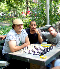
Some chess players want to keep the chess area as it is because Fisher played there and the movie "Searching for Bobby Fisher" was filmed there. But the parks department has said it might reduce the number of chess tables as part of its efforts to fight drug dealing in the park.
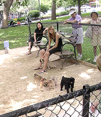
Another controversy surrounds the asphalt mounds. The plan would eliminate them, but some residents would like to see them saved. The mounds used to a playground, and people have proposed that a playground, intended for somewhat older children, be built there now. The park currently has two playgrounds, but both are crowded and intended for toddlers and younger children. The parks department says it will create new playgrounds, but that their locations will depend on the outcome of the litigation.
Some residents are also concerned about the proposed fence around the park, claiming that it would detract from the park's feeling of openness. But Gil Horowitz, president of the Lower 5th Avenue Block Association and chairman of the Community Relations Committee of the Square Arch Realty Corporation, points out that the park originally had a fence around it. The renovation, he said, "partially restores the feel of the original park, not as tall but partially."
Beyond the pros and cons of specific aspects of the plan, some in the community object to the way the parks department has made decisions.
"The parks department from the beginning has been dishonest about the design, has gone behind everyone's backs," said Leonie Haimson, a leader of community opposition to the park's redesign. "There is lots of resentment in the community about how the parks department went about this."
But Horowitz says that dissenters have had plenty of opportunity to voice their concerns: "The parks department has had over 100 meetings with community groups," he said, adding that the redesign "is one of the most discussed and debated topics in the community."
 The park redesign is being funded by a private-public partnership, meaning that the city only has to pay $6.8 million of the $16 million in costs. Private businesses and other contributors will cover the rest.
NYU made a $1 million donation. It says it supports the renovation as long as the park is available for commencement and the dog run is not moved in front of the library. The university, which dominates the surrounding area, is "agnostic" about the specific details of the plan, said Alicia Hurley, NYU's associate vice president for government and community affairs.
The parks department says the private-public partnership will provide enough money to pay for the renovations – and will even make possible a more extensive renovation than the city could have afforded on its own.
But, as with everything else about the renovation, there is dispute over the funding. Some critics worry that the private funding will place control of public property in private hands. And other New Yorkers question where the city will find the money to maintain the park. "They haven't found time and money to maintain what they have," said resident Karen Brooks. Eliza Nichols, the daughter of Robert Nichols who was the lead architect for the 1969 redesign, questions whether the parks department is taking on more than it can afford: "We're very afraid that we'll be stuck with a building site but no money for years."
A Cleaner, Safer Hell’s Kitchen Park
By Dan Rivoli
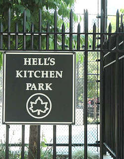
For years, parks department employee Frank Davis has been picking up litter in Hell’s Kitchen Park, on 10th Avenue between 47th and 48th Streets. The park, which opened to the public in 1979, had long been a haven for the homeless, peppered with broken beer and liquor bottles. For much of that time, it was an environment that reflected the shabbier aspect of neighborhood that surrounded it, Davis said. He recalls that he would “never see kids in the park before…. It was a dump.”
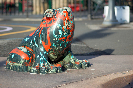
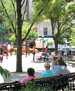
Now, though, a $1.24 million renovation of Hell’s Kitchen Park has made sunny days there picturesque: mothers chatting while their children rest in strollers or play and then cool off in the sprinklers. Others come to eat lunch or simply relax. The changes, spearheaded by community residents and the local block association, have also removed a source or crime and blight in the area.
Hell’s Kitchen Park is nestled between the large high-rise apartments and ground floor businesses that line 10th Avenue. Large trees grow around the perimeter of the park, providing shade. Thanks to the renovations, which were unveiled at a ribbon-cutting ceremony on May 16, an open space separates two playgrounds, equipped with clean water fountains and a red rubber mat for safety. For older kids and athletic adults, there are two graffiti-free handball and basketball courts.
 Before those with higher incomes started calling this piece of the West Side home, the area suffered from high crime. The park was a “drug den” and “a nice place for winos to drink,” said Elke Fears, president of the W 47 – W 48 Street Block Association
Since residents with higher incomes exerted their influence on the neighborhood, the park needed to follow suit. Residents worked hard to improve Hell’s Kitchen Park, said Fears, saying it “needed major renovations. The old, unsafe playground equipment needed to be replaced with safer, handicapped-accessible equipment.”
Crime was another issue. People came to the park to break the law because there were areas that could not be seen by the police from the outside. Now, thanks to the park’s new design, police can “see every corner,” Davis said. Before the renovation, the park did not have a fence, so there was nothing to stop people from sleeping on benches, or using drugs or alcohol at night. Now, the park features a fence, and it is against the law to be caught in Hell’s Kitchen Park when that fence is locked for the night.
The renovations finally were made in part because City Council Speaker Christine Quinn, who represents the district, used money from her discretionary fund.
Maintenance has been a joint effort by the parks department and members of the community, specifically the W 47 – W 48 Street Block Association..”
 The block association has “always been the shepherd of the park,” said John Doswell, co-chair of the waterfront and park committee for community board 4 “They kept it safe and kept their presence there,” he said. Community board 4 lends a hand as well.
Davis, the parks department employee, likens the care and maintenance of the park to that of a new car. When you get a new car, you want to keep it clean, he said.
Meanwhile other work remains to be done in this area of the far West Side. Doswell, co-chair of the waterfront and park committee for community board 4 says that De Witt Clinton Park, almost six times larger than the .58-acre Hell’s Kitchen Park, has yet to be renovated. “The larger park that needs attention is De Witt Clinton Park,” he said.
Gas Tank Park
By Alexander Perkins
For nearly a century, the Elmhurst gas tanks -- towering 200 feet above ground -- cast an imposing shadow over the local community and served as a landmark for commuters stuck in traffic on the Long Island Expressway.
“The tanks were an eyesore,” said City Councilmember Dennis Gallagher. And so, when the tanks outlived their usefulness, community residents fought to replace them with something more attractive.
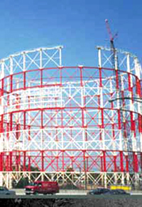 In 1996, the aging tanks, now obsolete, were torn down, and for the next five years, the KeySpan energy company parked its trucks on the lot.
In 2001, KeySpan announced that it would sell the 6.5-acre property on 80th Road and 57th Avenue. While developers envisioned shopping malls and big box stores, some local residents saw a rare opportunity to build much-needed parkland.
A COMMUNITY PROPOSAL
The Maspeth, Middle Village, and Elmhurst areas of Queens –the most densely populated section of the borough - are known for their high voter turnout in local elections and for being one of the few places in the city to elect Republicans to local office.
These middle-class neighborhoods are also known for a lack of open space, with just two acres of parkland for over 167,000 residents. (See a community profile in pdf format)
Hearing the news that the Elmurst gas tank site was for sale, a local group, the Juniper Park Civic Association, distributed surveys to gauge the residents’ opinions about the vacant lot. Of the 500 responding , 73 percent said they wanted a park, 16 percent said they favored residential development, and 4 percent called for a shopping mall.
Surveys in hand, the Juniper Park Civic Association approached KeySpan and asked the company to donate the lot to the city for open space.
“They (KeySpan) told us it was out of the question,” said Robert Holden, president of the Juniper Park Civic Association.
Other local leaders joined the cause, concerned that new commercial development would bring more traffic and pollution to the area.
At a meeting of Queens Community Board 5 in 2002, board member Tony Nunziato confronted a KeySpan vice president. “We’ve paid for your service and you profited from us,” said Nunziato. “By selling it and not giving the land to the community, you’re disposing of our quality of life.”
In December 2002, KeySpan agreed to sell the land to the Mattone Group, a Queens based development and construction company, which hoped to put in a Home Depot, a self-storage facility, and a bank.
Flooded with letters and phone calls from concerned constituents, City Councilmembers Melinda Katz and Dennis Gallagher and State Assemblywoman Margaret Markey intervened. At a March 2003 meeting, KeySpan Chairman Robert Catell agreed to postpone the sale of the site for one year to allow the elected officials time to find funding to purchase the land for the city. The asking price: $12 million.
PROTESTING AGAINST DEVELOPMENT
Over the next year, with elected officials and community groups unable to come up with the $12 million, KeySpan proceeded with their plans to sell the land.
Devastated by the news of the pending retail development, residents of Middle Village, Maspeth, and Elmhurst formed a community task force to confront what some dubbed “the KeyScam problem.”
Frustrated residents planned protests, discussed a boycott of the energy giant, and even hung large banners criticizing the company on the Long Island Expressway.
“Let’s boycott and shut off our gas together…it’s time to say enough!” Tony Nunziato urged a group of residents.
The battle became a focal point of neighborhood politics.
“I couldn’t believe how upset people were…it was definitely a hot button issue around here,” said Middle Village resident Janitza Betances.
In a final effort to address the issue, former Republican City Councilmember Tom Ognibene wrote a letter to Michael Bloomberg calling for the mayor to get involved.
Mayor Bloomberg, (who would later face a challenge from Ognibene for the Republican mayoral nomination), contacted KeySpan Chairman Robert Catell.
A week later, Mayor Bloomberg announced that the gas company would transfer the land to the city for $1, and the city would transform the Elmurst gas tank site into a public park.
However, not everyone was happy with the new agreement – particularly those who believed the retail development would have created 350 new jobs and $15 million in tax revenue for the city.
“I just don’t understand the mayor’s priority and how he arrived at the decision he made,” developer Joseph Mattone told the Daily News.
When asked about the sudden change of heart, a KeySpan representative said that the heavily populated community was deserving of “more open space” and would not comment further.
FUTURE OF GAS TANK PARK
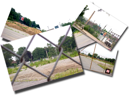
The site of the Elmhurst gas tanks
Although the deal between KeySpan and the city was brokered in 2003, the actual transfer of the land was delayed until November 2005 – four days before the reelection of Michael Bloomberg – because extensive environmental clean-up was necessary to meet the requirements of the Department of Environmental Protection for a public park.
With the park still in its tentative design stage, community leaders continue to stay involved by working closely with Partnership for Parks, a non-profit group, organizing community design meetings.
The community also debated what kind of park it should be: one with open green space or one filled with ball fields and recreational facilities. The Department of Parks and Recreation preferred the former.
Possible features of the aptly named “Gas Tank Park,” include trees to block out the neighboring Long Island Expressway, perimeter sidewalks, and a third of an acre playground.
The mayor and the City Council earmarked $20 million for park renovations, and the parks department anticipates construction to begin later this year.
“What’s certain is that it will be a welcome respite from city life, that will provide generations of Queens residents much needed recreation space,” said Parks and Recreation Commissioner Adriane Benepe.
Â
Funding the Parks Boom
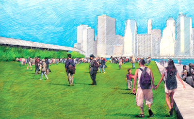
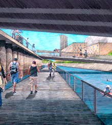
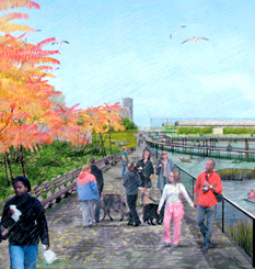
Artists conception of the proposed Brooklyn Bridge Park
The docks on the 1.3 miles of Brooklyn waterfront sit largely abandoned, their cavernous sheds empty, with only an occasional truck rattling by on rutted roads filled with weeds. But if all goes according to plan, by 2012 this remnant of the industrial New York of the 1950s will boast smooth pathways, playing fields, vibrant greenery and paddling kayakers along the shore.
Brooklyn Bridge Park is among the many new parks being constructed around the city. And like many of the others it will depend not just on taxpayer dollars, but on private funds.
Increasingly the city and state expect private groups to come up with the money to operate new parks. In Brooklyn Bridge Park, the plan is for this money to come from private luxury apartments within the park's boundaries. This proposal has sparked heated exchanges, angry rhetoric and a court fight. While an extreme case, the fight over Brooklyn Bridge Park is emblematic of the debate over how to pay for the city's green space.
ACRES OF NEW PARKS
The city is in the midst of a parks construction boom. Mayor Michael Bloomberg has said that, during his first term, the city added some 300 acres of parkland to the approximately 27,000 it already has. And more are on the way. Parks commissioner Adrian Benepe has predicted that 2006 will be the biggest year for parks construction in New York City since the 1930s. To help fund this, the parks department's capital budget has climbed from $550 million last year to $850 million the current fiscal year.
The projects are all over the city. A few examples:
-- The High Line: This abandoned elevated freight line in Chelsea will become one of the city's most unusual parks - a raised walkway with sidewalks, benches and landscaping.
-- Elmhurst Tanks: Using land donated by Keyspan, the city is converting another industrial site into a recreational center. (See related story.)
-- Fresh Kills: The plan to take the huge former garbage dump and make it a 2,315-acre park over the next 30 or 40 years is "the biggest and largest park project in the city's history," Benepe says.
-- The Bronx waterfront: The city's plan for Hunts Point calls for various waterfront parks and piers. While some of this is still just an idea, Barretto Point Park, also on a former industrial site, is set to open soon, complete with a beach, albeit off limits for swimming.
At the same time, the city is making improvements to other parks.(See related stories on Washington Square Park and Hell's Kitchen Park.)
This boom is the result of a number of things happening at once, said Benepe. Some projects long in the planning, such as Brooklyn Bridge Park, are finally coming to fruition. And, he said, the city has been actively seeking out new land, encouraging development of parks as part of new housing developments and considering even the unlikeliest of locations as a possible park site. The strong economy has also helped, Benepe said. (For more on planning parks, play Gotham Gazette's "Plan Your Future Park" game.)
Fresh Kills
FUND THE PARKS
The department has seen its budget reach about $220 million, up from about $150 million 10 years ago. "Quietly, the operating budget has been growing," Benepe said, "and the expectation is that it will continue to do so." As the amount of parkland increases, he said, so will spending and staff.
But parks advocates say the spending is not sufficient to meet the city's demands. As evidence, Christian DiPalermo, executive director of New Yorkers for Parks, an advocacy group, cites a 60 percent decline in park staff over the last 20 years. And advocates say that New York spends less than other cities on park related expenses: $78 per resident, far below the $276 spent by San Francisco, which ranked first in a study of city parks by the Trust for Public Land.
Most of the advocates say the city has managed to stretch its money -- helped by private contributions, volunteers and use of temporary workers. But that can only go so far, they say.
And so, they charge, a shortage of funds has resulted in poor conditions at dozens of parks. In the Report Card on Parks by New Yorkers for Parks, 38 of the 220 parks reviewed got a D or an F. Although this is fewer than in the previous year, the group says, "The gap in performance in the highest and lowest scoring parks in New York City continues to grow." The differences among parks, it said, are "staggering."
But Benepe rejects such criticism. "By every indication, the parks of New York City have gotten better over the last 30 years," he said. "Citizens have become more engaged in their parks, and the parks have improved as a result."
THE SELF-SUSTAINING PARK

The proposed visitor center at Fresh Kills
In exchange for acquiring land for and building a new park, city and state officials now often want private groups to fund part, if not all of the yearly operating expenses.
This "privatization" effort goes back to the 1980s when the Central Park Conservancy was created. It gave rise to other private groups that raise funds for and work with the city to maintain a specific park.
But some parks have been left behind. In an article on the city's worst parks, Timothy Williams of the New York Times concluded, "What these parks have in common is that they rely almost exclusively on city money, while the city's best-maintained parks... are managed in part by private conservancies that raise money and hire workers."
SOURCES OF MONEY
Since parks do not charge admission, how can they raise funds? And with so many parks being renovated and constructed, how can the city insure that restrooms remain open, play equipment works and that all of New York's parks remains safe and inviting? In other words, how will New York keep today's new parks from falling into the disrepair that characterized so many parks in the 1970s?
A number of methods are being used or considered:
Money from Controversial Projects
Bronx parks are receiving $200 million in extra city funds. But to get it, borough officials had to let the city build a water filtration plant in Van Cortlandt Park. The money will fund some 70 projects in the Bronx, including renovation of St. James Park and a $1.1 million project, with landscaping and a new fence and lighting, at Grant Park. Residents also hope some of this money will go to develop the Bronx waterfront.
Renting Facilities
Bryant Park plays host to fall and spring fashion showings and a Christmas gift market, among other events. This has proved so successful that the park is entirely self-sustaining; it does not require any city operating funds.
Hudson River Park hopes to generate revenues from a banquet hall in its boundaries. But few other parks have Bryant Park's advantages -- a midtown Manhattan location next to the42nd Street library and on top of several major subway lines. And for those that do, this approach can work too well and then limit the general public's access to the park.
Private Contribution
The Bloomberg administration has increased efforts to seek out private donations to fund public services. In 2003, City Hall launched the Adopt-a-Park program, aimed at smaller parks and spaces outside of Manhattan. It encourages individuals or groups to sponsor a park, a facility or even a lawnmower by donating money or labor. Now, taking a cue from concert hall seats and church pews, the department is encouraging people to "buy" park benches and, in return, get a plaque commemorating a loved one. New York park lovers can also support a tree and at least one resident has purchased granite stones, inscribed with the name of a friend or relative, in Tompkins Square Park.
Concessions
Some 600 businesses -- skating rinks, golf courses, restaurants, etc. - operate in the parks and produce about $60 million a year to city coffers. But the money from these concessions is not designated for parks; it goes into general revenues. DiPalermo would like to see that change - as long, he says, as the shift is not used as an excuse to cut general city funds for parks by a similar amount.
Energy Projects
While Staten Island hardly holds the prospect of being the next Saudi Arabia, Fresh Kills does provide some energy resources. Pumps extract methane gas, which can be used to provide heat and electricity, from the now capped mounds of decomposing garbage. According to the master plan, "harvesting of methane could provide a significant source of revenue to offset operating costs."
And engineers are evaluating whether the landfill - which even on a stagnant summer afternoon enjoys a fairly stiff breeze--could be a good place for windmills. Even if technically feasible, the plan could face a number of political obstacles but it has the support of Staten island Borough President James Molinaro who has said he wants to "to erect a wind energy facility at the Fresh Kills landfill [that] will tackle tomorrow's energy challenges today, right here on Staten Island."
Despite the money from energy production and facilities such as restaurants, a banquet hall and golf course, the city anticipates that Fresh Kills, which will cost hundreds of millions to build and millions to operate, will require government funding.
Real Estate Development
New parks, and provisions for funding them, are key to some real estate developments, such as Battery Park City and the rezoning of the Williamsburg-Greenport Waterfront in Brooklyn.
Friends of Hudson River Park is considering taking this a step further. Some of the money to operate the park, now being built along Manhattan's West Side, will come from rents, concessions and eventually a banquet hall and marina. But many doubt whether this will cover all operating and maintenance expenses.
And so, the New York Observer has reported, supporters of the park are investigating whether area businesses and property owners could be required to pay a fee, similar to the kind of assessment levied in Business Improvement Districts, to finance the park. One rationale for this is that proximity to a park has been shown to increase property values. If that effort fails, advocates could press for some kind of voluntary contribution.
BROOKLYN BRIDGE PARK
|
The planned shed for Pier 2 in Brooklyn Bridge Park |
Brooklyn Bridge Park also hopes to rely on real estate development to support the facility - but with a difference. In Brooklyn Bridge Park, the apartments will be not on private land on the park's periphery but within the boundaries of the public park itself.
The plans for the park go back to the 1980s, as the Port Authority mulled what to do with the largely abandoned piers south of the Brooklyn Bridge. The Port Authority initially wanted to sell the piersto private developers so that most, if not all of the area would be built up and off limits to the general public. But many neighborhood residents, concerned about the paucity of green space in the area, pressed for the site to become a park. In 2002, the state and city agreed to build the park for about$150 million. In return, the park would have to fund its $15 million in annual operating and maintenance costs itself.
Various option were weighed but eventually the Brooklyn Bridge Park Development Corporation, a state agency, concluded the best idea would be to build private residences at either end of the park. While people debate the numbers, the three buildings, ranging from 95 to 315 feet high, would cover about 10 percent of the park's total area.
Marianna Koval of the Brooklyn Bridge Park Conservancy, a citizens group that supports the park, said the development corporation should have consulted with the community on the plan. Despite that, she said, her group has concluded the residential development offers the best solution to funding the park. "It's a great plan and a great vehicle," she said - with private space occupying less of the park than it had in previous proposals.
Noting that the land where the park would be is zoned for manufacturing, she said the site could have been converted to a residential development. Instead, in exchange for private buildings at either end of the long, skinny space, residents will get a park with more than 74 acres of open space and an array of recreational facilities.
But other Brooklyn residents object so strongly to the private buildings that they have filed suit to block the plan. They say they want a park but think expensive private housing in the park undermines the very nature of a public facility. "This became overnight a housing development with green space," said Judi Francis of the Brooklyn Bridge Park Defense Fund, a coalition which opposes the plan. "They have manufactured this very, very expensive park to justify building housing."
Opponents contend the private housing could create problems, such as traffic in the park. But more fundamentally they worry that turning over public space to such a private use creates a bad precedent.
Francis said her coalition is open to other means to financing the park - creating a more economical plan, charging fees for certain park facilities or somehow taxing people who live closest to the park extra to support it.
PUBLIC VERSUS PRIVATE
|
A promenade along a marshy inlet, slated for Brooklyn Bridge Park. |
For better or worse, these kinds of choices are not open to many New Yorkers. Park advocates and residents of geographically remote or poor areas worry that the rush to private funding will only widen the already sizable gap between parks in rich areas and those in poor ones.
"Real estate developers like the fact that they can charge more for park views and are willing to pay into a fund," Majora Carter, founder of Sustainable South Bronx has said, discussing plans for parks in her neighborhood. "We don't have that luxury here."
Benepe says parks will be built in poor areas - and they will be maintained. "At the end of the day, taking care of parks is a city responsibility," he said.
Francis agrees. Just as we have police and fire protection and mass transit, she said, "We can have great parks that are supported by the public."
Koval, though, dismisses such comments as "nai"ve." "I would like the government to pay for these parks," she said, "but it's not going to."
Â
Community Gardens
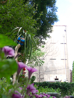
Prospect Heights Community Farm, Brooklyn
On a sunny spring Saturday, three boys fashioned a small rock garden at the Walt L. Shamel Community Garden in Bedford-Stuyvesant. Two older teenagers, Joevanni and Antonio, shoveled topsoil into wheelbarrows and ferried it to the back of the garden where they spread it out to make new planting beds. Rodney Duncan and Gregory Anderson, residents who are leading the effort to upgrade the garden and create a big community backyard, watched the young people work.
“One of the things we wanted was for children and seniors to get involved,” Anderson said. “You can’t have a better activity than this for children.”
Like most of the community gardens throughout the city, the Walt L. Shamel garden was reclaimed from a vacant city-owned lot in a poor neighborhood devastated by arson, crime, and abandonment. More than 20 years ago, residents around the city chased out drug dealers, cleared the rubble, and created green and safe spaces as diverse as their communities. Then, under Mayor Rudolph Giuliani, the city began the wholesale auctioning of the gardens – leading to fears that many of these community spaces would vanish in a city where almost every dispute comes down to a fight for space.
But today Duncan, Anderson and others can make big plans for their space because of a 2002 compromise that protected their garden and many others.
For the majority of gardeners, life has gotten a lot sweeter since the days when Mayor Giuliani seemed determined to wipe them out along with the squeegee men. But some gardens, especially in Harlem, remain threatened. “There’s a general sense that the struggle is over, but that’s really not true,” said Hannah Risely-White, the lead organizer at the Green Guerillas, which has been working with grassroots groups to create gardens for more than 30 years.
Four years after the agreement, what is the state of the city's community gardens?
OUT OF THE RUBBLE
As New York’s economy declined in the 1970s, arson and neglect left entire neighborhoods pocked with vacant lots, which became magnets for trash and drug dealers. The city seized a number of these lots because their owners had failed to pay the property taxes. Residents began to clean them up the land and plant gardens. The city allowed them to use the space with the understanding that it would someday reclaim the land. But the gardens came to serve an important function in their communities, many of which had few parks or other open spaces.
In the late 1990s, with the city on the rebound and real estate values rising, the Giuliani administration began taking steps to sell off many of the gardens. The mayor said that, in a city with homelessness and an acute shortage of housing, the land could be put to better use providing homes.
The gardeners countered that the city had many other vacant lots to develop for housing. They spoke of the role the gardens played in their neighborhoods in providing much-needed green space, creating a sense of community, educating children, and even growing food for low-income residents. The move to shut down the gardens sparked protests from gardeners and outcries from many quarters; the New York Times called the sale of the green spaces "an act of neighborhood violence."
In 1999, two non-profits, The Trust for Public Land and the New York Restoration Project, saved more than 100 gardens by purchasing them to be held in independent land trusts.
But several hundred more gardens remained threatened. Attorney General Eliot Spitzer, who recently told a gathering of gardeners that someone dressed as a sunflower first brought the issue to his attention, filed suit to block the destruction of the gardens.
In 2002, after Giuliani departed from City Hall, Spitzer and newly elected Mayor Michael Bloomberg settled the lawsuit. Their agreement protected 198 gardens outright and required a full public review of proposals to build on 114 gardens where development was to be allowed. Thirty-eight gardens that had already undergone a review were released for immediate development.
FRUITS OF THE SETTLEMENT
|
Community Garden on East 2nd Street |
Nearly four years later, the numbers look a little different as the review process has unfolded. Some of the gardens originally slated for development have been moved to new locations or saved as development projects made space for gardening.
The Department of Housing Preservation and Development, which has jurisdiction over nearly all of the gardens subject to development, works with developers to meet the city’s goals of creating more low and middle income housing on those sites. Some of the projects also include retail and community services. But in an unexpected turn of events, the department has been working closely with the parks department to preserve active gardens whenever possible by swapping them with sites on the protected list that never were gardened or are no longer being used by the community.
So far, just 45 former gardens have been lost, including the 38 on the immediate development list. Many of these sites now hold affordable housing or community facilities, fulfilling needs even the bereft gardeners concede are important. About 50 active gardens, though, still must undergo the review process and are likely to be developed.
THE PROTECTED GARDENS
All of the 198 gardens permanently preserved under the agreement have been transferred to the city Department of Parks and Recreation. Including the gardens that were already under parks jurisdiction, that brings the total number of parks department community gardens to around 300. Parks officials say that as long as these spaces continue to function as community gardens, they will have all the safeguards of parkland, which cannot be taken for another use without approval by the State Legislature.
“They’re as protected as the gardens are active,” said Deputy Commissioner Jack Linn. “That’s the ultimate bottom line of the compact between the city and the gardeners.”
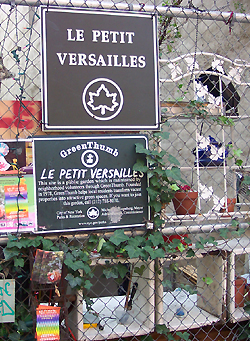
Park status provides a number of other benefits as well. Through the city’s urban gardening program, Greenthumb, the department has made major improvements to its newly acquired gardens, providing new fences and fixing hazards like broken sidewalks and dead trees. Greenthumb, which is federally funded, also gives topsoil, plants, and assistance to every site, whether it is officially a park or not, that meets its requirements: being open 10 hours a week and having at least 10 members. Director Edie Stone estimates there are about 500 Greenthumb gardens, including some slated for eventual development, in land trusts, under the jurisdiction of other city agencies, and on school property.
All of the gardens on city-owned land, including those that may be eventually developed, have been released from their biggest burden, the requirement that they carry private liability insurance. Thirty years ago, the Neighborhood Open Space Coalition was founded to provide affordable insurance for the gardens, but as rates rose steeply, the nonprofit was no longer able to absorb the costs. As of this spring, the city has extended its insurance protection to all gardens registered with Greenthumb.
MORE GARDENS SAVED
Unlike during the Giuliani administration, the Department of Housing Preservation and Development understand the benefits of gardens and has worked with the parks department, developers, and the community to preserve a number that otherwise would have been developed.
Nineteen gardens were saved in exchange for 21 sites that were protected but not being used, according to Holly M. Leicht, assistant commissioner for the Division of Planning and Pipeline Development at the housing agency. Many of the gardens were in East New York, “where there were a number of really high quality gardens that looked like they were going to be destroyed,” she said. A final swap is in the works to save eight more gardens.
Several projects have also been redesigned to accommodate gardens, said Leicht. That includes the Melrose Commons urban renewal project in the South Bronx, where a compromise with two grassroots gardening groups, South Bronx United Gardeners and the, More Gardens! Coalition ended up preserving half of the acreage for gardening, although a number of gardens were moved.
“They have some really good people at HPD working really hard to save gardens when they can,” said Tom Congdon, a policy analyst who is the attorney general’s point person on the issue. “That’s a huge shift from when we first got involved in this issue in the late 1990s.”
Leicht, who used to be on the other side of the issue with the Municipal Art Society, says balancing demands for green space and affordable housing presents a constant challenge. “All the more I understand the importance of thinking of these spaces individually and finding the balance between the two needs, because they’re both great needs in all of the communities,” she said.
AN UNCERTAIN FUTURE
Some community gardeners wonder whether development pressure could threaten even those gardens under the parks department’s jurisdiction. “Parks will say, â€If you can keep it running to standards, it is protected. But that’s not the way official parkland works,” said Dave Lutz, director of the Neighborhood Open Space Coalition. “What’s going to happen when a developer looks at a garden and says, â€This property is superb. We can turn it into a 17-story apartment building and name it â€Once Was a Garden’? What elected official can resist a well-endowed developer?”
The question of how the city will handle that looms even larger for gardens still subject to development. Under the 2002 agreement, gardeners must be notified that there is a building proposal pending for their site, what the review process will be, and what, if any, alternative sites are being offered for the garden. If the gardeners don’t accept a new site (which can be up to half a mile away) or if no alternative is available, that information becomes part of the public review.
The process is meant to give gardeners a fighting chance to persuade the community board and local council member of the importance of their space. But given the imperfect nature of the city’s land use reviews — the most commonly used is the Uniform Land Use Review Process — gardeners have the best chance of success if they are savvy about the political process and act quickly when they receive notice that their garden is under review.
“We tell the gardeners all the time, when you get that initial letter saying your garden is subject to the following development, and we are offering you alternative sites, this is the notice to stay involved in the process,” said Congdon. “It is incumbent upon the gardeners to reach out to local council members and community board members” to present their case and make sure they have a presence at meetings and hearings.
In most cases the local community board and council member have final say. So far, very few projects at sites on the subject-to-development list have been rejected in favor of keeping a garden.
A number of gardens have moved to other sites, often on the same block, said Edie Stone of Greenthumb, although she couldn’t provide an exact count. And in other cases, gardeners from several sites have doubled up in one space.
The reviews of the remaining gardens are expected to be completed by the time the agreement expires in 2010.
STANDING THEIR GROUND
One third of those 50 gardens are in Harlem. The housing department says that it has no alternative sites there to offer gardeners as it faces pressures from the red-hot real estate market and the local community’s demand for more affordable housing. Almost all the other vacant lots in Harlem are privately owned.
|
Peachtree Garden in the East Village |
Alex Brown, one of the leaders of the Harlem United Gardeners, lost his garden on Eleventh Avenue two years ago. But he continues to fight on behalf of other gardens in Harlem.
Brown’s group seeks to make developers and Harlem’s City Council members more aware of the benefits of community gardens. Schools use them to teach students about plants and ecology, and residents grow fresh fruits and vegetables for themselves and local food programs. Brown believes gardens also help prevent crime: “Lots of youth who see what’s going on inside the gardens get some kind of appreciation for life and gardening, and how it can bring more peace in mind and body.”
“One of the most important things — and that’s what developers see — is the pride and beauty that community gardens bring,” he said.
A recent study by the New York University School of Law backs this up. It found that the creation of a community garden has a positive impact on nearby residential property values and is associated with a neighborhood’s economic revival.
The Harlem gardeners are currently focusing their efforts on the Nuevo Esperanza garden at 110th Street and Fifth Avenue, which is facing imminent development. Reprising the protests of the Giuliani era, members of the garden and the More Gardens! Coalition have been camping in the garden prepared to face down the bulldozers.
The garden was originally slated to be replaced by an Edison Company charter school, to be built in partnership with the Museum of African Arts. Edison planned to buy another site for the gardeners to use. But gardeners lost that option when the company backed out and the development was changed to a 40-story market-rate condominium building, which is helping to make the building of the museum possible.
The project has brought to the surface the resentment simmering in Harlem over race and class as skyrocketing real estate prices and gentrification squeeze out current residents. The protests have as much to do with the city providing a valuable piece of land to a well-connected developer for condos as it does to losing the garden.
“We want to see some plans that include the community and not just shoves them off because luxury housing is coming,” said Aresh Javadi, co-founder of More Gardens! “Without these gardens there never would have been this change of people wanting to live around here.”
“Gardeners are not against housing,” said Javadi. “They want housing and they want the green spaces to stay.”
CHANGING COMMUNITIES
But while Harlem may present the starkest example of the pressures of increasing real estate prices on community gardens, changes in communities throughout the city present challenges for the gardens – even those that have been saved.
Many of the people who stuck it out during the bad times and worked to improve their communities can’t afford to live in these neighborhoods anymore. Gardeners find that people who recently moved to an area may need to work two or more jobs just to afford their homes and don’t have the time or interest in gardening. “
Often new people coming into the neighborhood like having the gardens there but don’t actually want to garden,” said Risely-White of the Green Guerillas, one of the groups helping struggling gardens recruit new members.
Stone said, “What we’re working on right now is keeping gardens sustainable for many generations into the future. They’re permanent, so we have to make sure there is somebody to care for them forever.”
For More Information:
Rats to Roses, a Sierra Club documentary scheduled to air this summer, covers the New York City community garden controversies of the 1990s. It focuses particularly on the Lower East Side’s Esperanza garden, which was bulldozed just hours before the injunction was granted preventing the destruction of community gardens pending the resolution of a lawsuit by the state attorney general.
Â
Closing The Park Loop Drives To Cars?
With New York City anticipating an additional one million residents over the next quarter century, the battle over how to move people in and around the city will only intensify. How much roadway space should be devoted to auto and truck travel, and how much preference should be given to buses, pedestrians and bicycles? What are the implications of these choices for economic growth, time wasted in traffic delays and overall quality of life in the city?
This core issue is like a giant iceberg that pokes to the surface in various places: congestion pricing, parking policy, bike lanes, bus rapid transit, expanding sidewalks. The latest sighting is in the parks. A City Council bill sponsored by Manhattan Councilmember Gale Brewer, and cosponsored by council members whose districts border Central Park and Prospect Park, would close the Central Park loop drive throughout the summer. The bill would also close the Prospect Park loop drive in the afternoon while leaving the drive open for two hours in the morning peak period. Currently, the park drives are open during weekday morning and afternoon peak periods and are closed midday, in the evenings and overnight. (See exact hours here.)
The Council bill raises two basic issues. First, who should be given preferential treatment in the park: people in cars or people out of cars? Proponents argue that these two historic parks were designed and built as refuges from the hustle and bustle of urban life and should be reserved for strolling, running, biking, rollerblading and other leisure activities. Opponents of the bill, including Department of Transportation (DOT) officials who testified at a recent City Council Transportation Committee hearing, argue that the park drives are vital components of the city's street system. They point out that the park drives are already closed for most hours of the day and night, and that a few hours of traffic a day balances the needs of motorists and park users. (Before continuing, a disclosure: I testified in favor of the bill at the Council hearing.)
The second issue concerns traffic impacts. Department of Transportation officials passionately contended at the council hearing that the park drives must be kept open at peak times to prevent unmanageable increases in traffic on alternate routes outside the park. Proponents of the bill maintained that these fears are exaggerated because some drivers will switch to other modes such as bus, subway, walking or biking, and because there is currently street capacity to absorb the traffic diverted from the park drives.
The bill itself acknowledges the importance of the traffic concerns; it would close the park drives from June 24 to September 25 of this year only. The bill calls on the Department of Transportation to study the traffic impacts of this pilot program and submit a report by the end of the year. The City Council would presumably revisit the issue early next year before deciding whether to repeat the closures in future summers.
The drives were rarely closed at all before 1966, but there has been a steady reduction in the hours that cars are allowed in the park, as well as other restrictions (such as a requirement that all cars have two or more passengers on certain roads during certain times of day). There has been a drop in traffic over the years as well. Peak hour traffic in Central Park declined 23 percent from 1991 to 2004, according to a transportation department report, which found that new restrictions in 2004 did not significantly affect traffic volume on adjacent streets.
Facing solid council support for the bill, the day before the Council hearing Mayor Michael Bloomberg announced with transportation officials a new mayoral plan for additional closures of the park drives. Essentially, the mayor's new plan is to close the drives in the non-peak direction (for example northbound in Central Park during the morning) for six months starting June 5.
The City Council will now have to decide whether to accept Bloomberg's partial closures, or proceed with the bill to close Central Park drives completely and the Prospect Park loop except for two hours on weekday mornings. If the council adopts the bill, Bloomberg will have to decide whether to veto it. A veto could be overridden by the Council.
The mayor's plan moves in the same direction as the Council bill, but it raises a third issue: safety. Anyone who has jogged or biked in either park while rush hour traffic is whooshing by knows that the feeling is not exactly one of bucolic relaxation. But actual accidents seem to be remarkably rare, presumably because park users as well as drivers get used to the others' presence. The mayor's plan allows joggers, bikers and rollerbladers to have free rein of part of the loop, then requires that they squeeze back into the jogger/bike lanes for another part of the loop. How safely this arrangement will work has not been tested.
Transportation officials believe that motorists and park users will quickly learn and adapt to what some see as confusing and complex aspects of the mayor's new plan. And well they might. But the same might be true of closing the park drives entirely. It is interesting to note the pattern from the December 2004 Holiday Plan closure. The Holiday Plan was designed to reduce traffic - and traffic fell. The Department of Transportation report concludes that the plan was a success: "The project met or exceeded expectations for improving mobility, promoting alternative modes of transportation and improving safety without adversely affecting traffic conditions."
The transportation department also closed down the drives during peak hours in February, 2005 to accommodate setting up and taking down the "Gates" exhibition. The Gates traffic plan was designed to move more traffic on streets outside the park -- and it too succeeded. While there was an increase in traffic, there was also an increase in traffic speed, because the agency undertook steps to improve traffic flow.
The lesson from these experiences seems pretty simple: with some smart planning, you can in fact get what you want. Thus, it would seem that if the City Council and Bloomberg Administration want to reserve these crown jewels of the city's park system for the peaceful enjoyment of its citizens, they could close the drives "without adversely affecting traffic conditions." At least, many say, it seems worth a try.
 Bruce Schaller, who has been in charge of the transportation topic page since its inception in 1999, is head of Schaller Consulting, which provides research and analysis about transportation. He is also a Visiting Scholar at the Rudin Center for Transportation Policy and Management at New York University.Â
Parks Budget For 2007
In recent years, the city’s parks have become greener and cleaner as a result of a substantial increase in capital spending for park renovation, as well as the growth of park groups that raise private funding for maintenance and provide volunteer labor. Many new parks, large and small, are in the works, including the High Line, Fresh Kills, and a new six-acre park on the Keyspan site in Queens.
At the same time, however, city allocations to maintain the parks and provide recreational programs, cut repeatedly over the last two decades, have not been restored. The parks department has made effective use of the resources it has, including temporary workers in various welfare-to-work programs funded by the Human Resources Agency. Its internal inspection ratings of park conditions are at an all-time high, according to Parks Commissioner Adrian Benepe. But a comparison of the beautifully maintained plantings and trees, lush lawns, and green ball fields in privately funded Central Park with the scraggly grass, dirt fields, and trees in need of pruning in, say, Queensbridge Park, illustrates how more horticultural attention could improve many parks.
The city’s annual budget process works against any significant increase in funding to care for the parks. Typically, the mayor proposes a baseline that is lower than the previous year’s adopted budget, and the City Council adds back in most or all of the items that were cut. This keeps the focus on restoring programs instead of adding funding.
This year, the mayor’s preliminary budget eliminates $14 million for 600 seasonal park employees, the entire street tree pruning effort, and an after-school program at the recreation centers. It also cuts the one major new budget item from last year, the 50 new Park Enforcement Patrol officers added amid concern about crime in the parks, which had increased the force to 110. In early April, three of the newly hired PEP officers stopped an attempted rape in Forest Park in Queens.
“Saving lives shouldn’t be part of a budget dance,” said Christian DiPalermo, executive director of New Yorkers for Parks, the citywide parks advocacy group. “I think that we should all just agree these are necessary programs and they should be funded. More energy should be put by the Council and the Mayor to improving park service with additional funds, particularly when there is a surplus.”
Park advocates are lobbying for the council to add $9 million to the parks budget to almost double the PEP force to 200 officers and to increase the frequency of tree pruning from the current ten-year cycle to the generally accepted standard of pruning each tree every seven years.
The additional funding would also include $3 million for expanding the Neighborhood Parks Initiative, a partnership of the parks department, the City Parks Foundation, and the Central Parks Conservancy inaugurated in 30 parks last year. The program assigns a full-time gardener and playground associate to outer-borough parks in need of better maintenance. The Central Park Conservancy helped train the new gardeners, the first to be hired by the parks department in years. One of the goals is to disseminate the practices that have improved Central Park so dramatically, including the zone management system that gives gardeners personal responsibility for a specific section of the park.
Drawing Revenue from the Parks
The parks department also raises about $60 million a year through concessions and various fees. The money goes into the general fund, not directly to parks, but it helps buffer the department from budget cuts.
For the next fiscal year, the city is proposing to bring in additional revenue by charging membership fees at the six recreation centers receiving federal Community Development Block Grant funding. These recreation centers had remained free in 2003 when the city began charging visitors to most centers. The fee is $50, or $75 for centers with pools. (Children up to age 18 can still use the centers for free, and there is a reduced senior fee.)
The new fees are projected to bring in $2 million. But that revenue goal may be unrealistic, according to the Independent Budget Office. Its recent analysis of center use and revenue after the fees were instituted found that attendance dropped at the centers charging the higher amount, while it increased at the free and less expensive centers.
The analysis suggests that once fees are imposed at the formerly free centers, fewer people -- especially from the lower income populations that are at higher risk of obesity and diabetes -- will use them. If charging for using park facilities ends up discouraging people from using them, it undermines the mission of the parks department as well as the larger public policy goal of improving the health of residents.
Commissioner Benepe takes issue with that conclusion, however. “What we have found is that when it’s free, lots of people join, but very few people actually come,” he said. “When people pay, they tend to use it more.” He noted that the fees were a fraction of a typical health club membership. He also said there was no difference in the socioeconomic status of people using the community development-funded centers and the others, so that it was more equitable to charge a fee at all centers.
The Independent Budget Office also looked at what happened when the parks department raised the price of a season’s tennis court pass from $50 to $100. Doubling the price led to a 40 percent drop in the number of passes sold, resulting in only a 16 percent increase in income, part of which came from higher sales of one-time use passes. The budget office found that tennis court usage “appeared to have dropped off significantly,” and concluded that a smaller price increase might have resulted in both greater total revenues and court use.
 Anne Schwartz, in charge of the parks topic page since its inception in 1999, is a journalist who specializes in environmental issues.Â
Protecting The Park In The Parkway
Snow can make parks look like heaven – and roads feel like hell. But it was a previous snowstorm that made it clear how much New York City’s parkways — which are both parks and roads — are in a weird kind of limbo.
|
Scenic byways prevent the proliferation of billboards |
Mayor John Lindsay had reorganized the city’s agencies so that, when the blizzard of February, 1969 hit, it was unclear whose responsibility it was to clear the parkways – and they remained unplowed for three days, paralyzing the city.
No mayor will ever make such a politically costly mistake again; the Department of Sanitation very clearly now has the job of removing snow from the parkways.
But a complicated bureaucratic system remains in place, which is causing real damage year-round.
Last year, a great stone wall in Washington Heights collapsed onto the Henry Hudson Parkway, the most visible evidence of the sinking fortunes of America’s first and once-glorious urban parkway. Last month, a deal to restore the parkway collapsed as well. Even the prospect of millions of dollars in new federal funds for the city was not enough to overcome a system set in place that values roads over parks.
Many people may hear “parkway” and just think “highway.” Others realize that a parkway is in fact a road through a park. But a parkway is not just the road itself; it is also the parkland on either side. New York City’s parkways, a monumental public works project achieved jointly in the 1930’s by FDR, LaGuardia and Robert Moses, were designed as the most extensive urban park system in the world. The Henry Hudson Parkway alone, which runs from West 72nd Street in Manhattan to the top of the Bronx, links together four major parks, nine smaller ones, countless pocket parks and great swaths of untouched nature. Even now the beauty and coherence of the vision is clear to anybody who takes the time to notice—not just the stunning natural and manmade features revealed with each curve and dip of the road, but the details that highlight the character of each section: art deco and rustic wooden guard rails, cultivated wilderness, esplanades for promenading and trails for meandering …and lovely stone walls.
It becomes harder and harder, though, to miss the damage. Concrete jersey barriers cover miles of stone walls and steel hairnets cover natural rock outcrops. Signs and billboards clutter the stone bridges of the Bronx and the skyline of Manhattan.
If that’s the motorist’s experience of the city, the resident’s is even sadder. Pedestrian tunnels and stairs that once led to the waterfront are abandoned. The expressway aesthetic spills over to neighborhoods. Huge parkway entrance signs loom over quiet streets in Riverdale. Harlem residents look out at billboards instead of the river.
Five years ago, I was one of the concerned residents who formed the Henry Hudson Parkway Task Force to reverse its fate. The way we realized this could happen is by getting the state government to agree to designate the parkway a Scenic Byway, under a special program created in 1992 to preserve the nation’s most beautiful roads. Scenic Byways are eligible for special federal funds—and not just transportation funds. When the 8.2 mile Pasadena Freeway (also known as the Arroyo Seco Parkway) was designated a Scenic Byway a few years ago, its state transportation department received a billion dollars in federal environmental funds to restore its landscape and bridges.
The New York State Department of Transportation, which administers the Scenic Byways Program, was enthusiastic about the Henry Hudson Parkway being the city’s first candidate. Besides its historic credentials, the parkway had acquired new importance. It is the site of the Hudson River Valley Greenway, the walking and bicycle trail that will eventually go from Battery Park to Saratoga, New York. Since the city and state are both pouring millions of dollars into building the greenway and revitalizing Manhattan’s west side waterfront, it made sense to include the parkway in the plan.
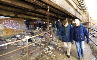
An example of paths and stairways under the parkways that are neglected (south of the George Washington Bridge).
It leads to the beautiful Ft. Washington Park.
But the application to make the Henry Hudson Parkway an official Scenic Byway was withdrawn. The reasons why are not known to the public: Though the agencies that make these decisions are public, they deliberate in secret.
What is known is that, like all of the city’s parkways, the Henry Hudson is an entanglement of jurisdictions. Decisions about its future are determined by a combination of agencies that meet together as the New York Metropolitan Transportation Council, which acts as the official regional planning body. The most important agencies within that body are the city's and state's transportation agencies. The most irrelevant agency is the city's Department of Parks and Recreation. Even though the parks department is officially a co-owner of the city’s parkways, it is not a member of the transportation council, nor is it even part of its advisory board. It has the smallest budget and the least political clout. Even if the parks department were part of the transportation council, however, it might not make a difference because the council is organized to protect the fiefdom of each member -- a rule requiring "unanimous consensus" gives each member a veto.
So, apparently, at least one of the transportation agencies involved in the New York Metropolitan Transportation Council got cold feet about the parks-oriented requirements of a Scenic Byways designation.
|
Parkways are designed to conform to the natural topography. Curves like this are what provide the sequence of stunning views. Unfortunately they are irresistible “straightening” projects for transportation departments in the name of “uniform [higher] speed limits” |
A scenic byway is about design guidelines. One can address the problem of graffiti in a parkway by painstakingly removing the graffiti and maintaining the beauty of the stone wall, or by quickly painting over it. One can mow the daffodils in a field so that they never come up again – or one can mow the field after it has become fallow, and keep the daffodils spreading for the next 20 years. To preservationists and parks enthusiasts, how one takes care of graffiti or daffodils makes a huge difference. But efficiency might be the by-word to those shortsighted enough to look at the parkway only as a means of transportation.
The city Department of Transportation may not want to have to keep the kind of wooden guide rails that are used along the Northern Parkway in Long Island or the Merritt Parkway in Connecticut (both scenic byways). It has its preferred way to protect stone parapets on the city's bridges -- with jersey barriers topped with chain link. The problem is compounded by the entanglement of jurisdictions. What one agency builds, another maintains. Each government agency is jointly and severally liable; even individual engineers can be held liable for projects they sign. The consequence is a hodgepodge of defensive design -- overbuilt and overpriced.
Fifty years have passed since the enactment of the 1956 Federal Aid Highway Act, the nation’s interstate highway system has been fully built for a decade, and our auto companies are now in open retreat. Yet none of this seems to have loosened the grip of the highway builders over the design of New York City. Having a metropolitan planning organization was supposed to stop the city from being strong-armed by the state transportation agency. Instead it is strong-armed by four transportation agencies and authorities, each fiercely protective of its prerogatives.
The scenic byway plan couldn’t have been derailed at a worse time. Both the new New York State Transportation Bond Act and the Federal Transportation Bill contain substantial funding for the parkway. Some of the money will be used to enhance the parks and waterfront. But with no plan in place, and no declared attention to the aesthetics, much of the money may well be spent in ways that undermine the park part of the parkway.
Hilary Hinds Kitasei is a free-lance writer and founder of the Henry Hudson Parkway Task Force Â
Parkstat To Fight Crime
The murder in Inwood Hill Park of Juilliard drama student Sarah Fox, who was killed in May 2004 while she was out jogging, had a chilling effect on residents’ use of the park. Tamara Ewoldt, who has lived near and run in the park for 15 years, stopped going there alone and organized a neighborhood runners’ group so people could run together.
Last July, another female jogger was assaulted in the park, escaping with injuries. Ewoldt and other residents, who want the park to be patrolled more effectively, had trouble getting information about the attack. “It’s important that local people have information about our park,” she said, “so that we can decide how we use it safely, and whether we use it at all.”
The only park for which crime statistics are available is Central Park, which has its own precinct. Compstat, the city’s highly regarded system for reporting, mapping and analyzing crime, does not identify crimes in parks. Parks Commissioner Adrian Benepe says that the parks, like the city as a whole, are safer than ever. But when people hear about crimes from the headlines, they feel uneasy about the places they go to play, exercise, and unwind -- the very places they feel most vulnerable.
A recently enacted law requiring the police to report felonies that occur in the parks will begin to fill the information void and may help the police and community better fight crime. “From now on when it comes to crimes in the parks, New Yorkers will no longer be left in the dark,” said Councilmember Peter Vallone, Jr., chair of the council’s public safety committee, who introduced the legislation with Councilmember Joseph Addabbo.
On signing the bill, Mayor Michael Bloomberg said, “This measure will continue the Administration’s commitment to open and transparent government.” The law fits with a growing trend for cities to collect, analyze, and make data publicly available, and to use it to hold managers accountable for improving city services.
Because of the technical difficulties and extra work involved, the police department initially was very reluctant to report crime in parks, as they do for the transit system and housing projects. It took two long, hard years of negotiations, led by Vallone, to reach a compromise acceptable to the police, the mayor, the council, and park advocates. The agreement phases in the reporting requirement over three years.
To begin with, the police department will provide data on all major felony crime complaints in 20 of the city’s large parks in its quarterly reports to the City Council, which can then make it available to the public. The 20 parks are being selected in cooperation with the parks department, but will likely include Inwood Hill Park. Eventually, all parks one acre or larger will be included.
The new measure has been called Parkstat, which is confusing because the parks department uses the same term to refer to its system for rating and improving park conditions.
The key to the effectiveness of the new law will be training police officers to more accurately report crimes that occur in parks. Under Compstat, the location of a crime is indicated using the nearest street address. Before, officers filling out a report had the option of reporting that the crime occurred in a park. The specific park was not named. There was no indication of whether the crime actually occurred in the park or whether the suspect was simply arrested there. Vallone said, “We have a commitment that they will improve their reporting methods.”
The parks department already uses police department crime data, running the information through the filters on its computerized mapping system to try and identify the specific parks, said Liam Kavanagh, first deputy commissioner of the parks department. They use the information internally, to coordinate their efforts with police precincts and make sure park staff is aware of criminal activity. But the information is incomplete and not available to the public. “I don’t think simply reporting on the basis of parks will in itself lead to a dramatic reduction in crime, but more information is better,” said Kavanagh. “I think it’s going to show how safe parks really are in relation to serious crime.”
Paul Browne, deputy commissioner of public information for the police department, said, “Time will tell whether it reveals any particular advantage.” He cautioned that crime rates need to be considered within the context of how many people use the park. Parks that have more visitors have more incidents of crime.
Although the police department handles serious crimes in the parks, the parks department has its own Parks Enforcement Patrol, which enforces park rules and issues summonses for offenses ranging from littering and climbing trees to defacing park property and disorderly conduct. PEP officers don’t carry guns, but their presence in the park is a deterrent to crime. According to Kavanagh, funding increases in last year’s budget allowed the department to add 60 new PEP officers, bringing the citywide total to 154 (although several dozen are assigned to recreation centers and training and are not patrolling). Even so, with more than 1,700 parks, playgrounds, and other facilities in the parks system, PEP officers are spread thin.
Park advocates hope that the crime data will shine a spotlight on parks or areas that are problematic and help focus resources where they are needed. In addition, said Christian DiPalermo, executive director of New Yorkers for Parks (www.ny4p.org), the citywide parks advocacy group, “The more people know the more they help the cops to deter crime.”
“The data could be used to help park managers learn what is working in one park that could be used in another,” he added. On the flip side, a sensational crime with a lot of coverage in the press can discourage people from using a park that is actually very safe, he said. “Tracking gives you perspective.”
 Anne Schwartz, in charge of the parks topic page since its inception in 1999, is a journalist who specializes in environmental issues.Â
Turning The High Line Elevated Railroad Into An Unconventional Park
In one of his last acts in office, Mayor Rudy Giuliani approved the demolition of the High Line, an abandoned elevated freight railroad running through Chelsea and the West Village. The owners of property shadowed by the hulking structure wanted it torn down. The idea of reinventing the tracks as a public open space, proposed by a grassroots group called Friends of the High Line, was a fantasy that few people gave any chance of success.
Fast forward three years. This October, the city announced the selection of a design team to make the track a public promenade, as well as the dedication of $43 million to the project, which has an estimated total cost of between $60 and $100 million. The State of New York and CSX Transportation, the railroad that owns the line, joined the city in petitioning the federal Surface Transportation Board to rail-bankthe line, which would transfer the easement to the city and allow its use as public space. If all goes as planned, construction will begin next fall. Against all odds, a crazy and impractical-seeming idea is rapidly becoming a reality.
The High Line was built in the 1930s to serve the refrigerated meat and dairy warehouses of the West Side, taking dangerous freight traffic off Tenth Avenue. Part of the line was torn down in the 1960s, and the remaining segment, from Gansevoort to 34th Street, was taken out of service in 1980. It was mostly forgotten, except by architects, preservationists and adjacent property owners.
The few people who discovered the rusting track, overtaken by weeds and wildflowers, were captivated by its solitude and mystery. Some likened it to a magic carpet ride -- a tapestry that changed with the seasons, floating two stories high through industrial precincts, just above the streets but open to the sky and river and cityscape.
In 1999, West Side residents Joshua David and Robert Hammond founded Friends of the High Lineto save the line and take advantage of a rare opportunity to create open space in an area that desperately needed it. To their surprise, they quickly gained the support of local residents, civic organizations, and businesspeople, including the owners of art galleries in West Chelsea. "The power behind the project was that it was a dream, a dream-like vision, we were making a reality," recalled David. "It seemed like something wonderful and impossible. And as soon as people got the sense that this wonderful, seemingly impossible thing was possible, it created incredible excitement."
Elected officials started coming on board, including City Councilmember Christine Quinn, who represents the area, and Council Speaker Gifford Miller. A turning point came with the election of Mayor Michael Bloomberg, who quickly reversed the city’s course and began the rail-banking process early in his term.
Mayor Bloomberg and Department of City Planning Director Amanda Burden envision the line tying together three areas that are the focus of city revitalization efforts: the Gansevoort Historic District, West Chelsea, and the far West Side between the 30s and 42nd Street, including the site of the controversial proposed stadium complex. Mayor Bloomberg called the High Line "a beautiful new amenity that will serve as the spine of vibrant new neighborhoods on Manhattan’s Far West Side and create new economic benefits in the years to come."
A Completely Different Kind Of Park
In making their case to preserve the tracks, Friends of the High Line frequently cited the example of the Promenade Plantée, a landscaped walkway on a rail viaduct crossing the 12th Arrondissement in Paris. Reflecting the classic beauty of the city it overlooks, the promenade is a linear formal garden, a path bordered and interrupted by neatly edged beds of flowers, shrubs, and trees. The first park ever built on an elevated line, it has been a huge success, attracting many more visitors than expected and spurring the construction of apartment and commercial buildings in the surrounding area.
Although the concept of the High Line as a landscaped pedestrian walkway was inspired by its French predecessor, the design is shaping up to be something different altogether — unlike any other park and unique to New York.
"People are looking for a design that refers to the special qualities that are up there now," said David. The goal is to capture the disused track’s wildness, its grittiness, its evocation of the city’s industrial past, and especially its sense of serenity. Yet the park will need to accommodate large numbers of people, a variety of public uses, and the commercial activities that will inevitably arise in the adjacent spaces.
After narrowing down 70 proposals to four finalists, a selection committee representing five city agencies and Friends of the High named a design team led by the landscape architecture firm Field Operations and architects Diller, Scofidio + Renfro to create the master plan.
The team’s provocative preliminary concept looks more like a work of modern sculpture than a traditional park. It is based on parallel concrete planks that fade in and out of a landscape ranging from gravel and grasses to a more cultivated type of garden. In some sections, the volunteer vegetation and rusting metal of the existing line would remain intact. The architects envision the line as a slow, meandering path that at times dips below or curves above the tracks, with places for both quiet reflection and public activities and events.
In October, more than a hundred people came to a community input forum to view a presentation of the preliminary concept and offer their ideas, concerns, and hopes.
Most of those attending agreed that the park should be a "slow lane," a place to meander, meditate, and enjoy the views. They noted that there is already a well-used route for bicyclists and skaters just a few blocks away at the Hudson River Park. Other community concerns were safety, enough seating, connections to the river, and guarding against the encroachment of commercial activities. The design team will return to the community with an update on December 2, at the Chelsea Recreation Center.
Open Space As A Catalyst For Change
Unlike the typical development approach that throws in a park or two as a sweetener to make large new construction projects more palatable to the public, the effort to reuse the High Line starts with the premise that open space can be at the heart of neighborhood revitalization.
And in contrast to the city’s top-down plan to build a stadium and redevelop the area just to the north, which has generated tremendous neighborhood opposition, the High Line project is a model of local planning. It began at the grassroots and included the input of local residents and businesses as it evolved. According to Joshua David, there has been a remarkable and productive collaboration among Friends of the High Line and numerous city agencies, including parks, city planning, transportation, and economic development.
The Department of City Planning has put together a proposalthat weaves the High Line into a larger plan for rezoning West Chelsea. The plan aims to encourage the construction of more housing in the area, yet retain the area’s manufacturing and protect the thriving art gallery district that has emerged between 10th and 11th Avenues.
To keep light and air around the High Line, the plan would restrict the heights of adjacent buildings, while allowing their owners to sell development rights that could be used in other parts of the district. It also offers incentives for providing access to the line. The public review process for the zoning change is expected to begin in December.
Developers are starting to take interest in the area, as planners had hoped. But along with new development comes the risk of increased commercialization. The challenge going ahead is to make the High Line a true public space – not just a mall in the sky – that captures the excitement of the original vision.
 Anne Schwartz is a freelance writer specializing in environmental issues. Previously, she was the editor of the Audubon Activist, a news journal for environmental action published by the National Audubon Society, and an editor at The New York Botanical Garden.
