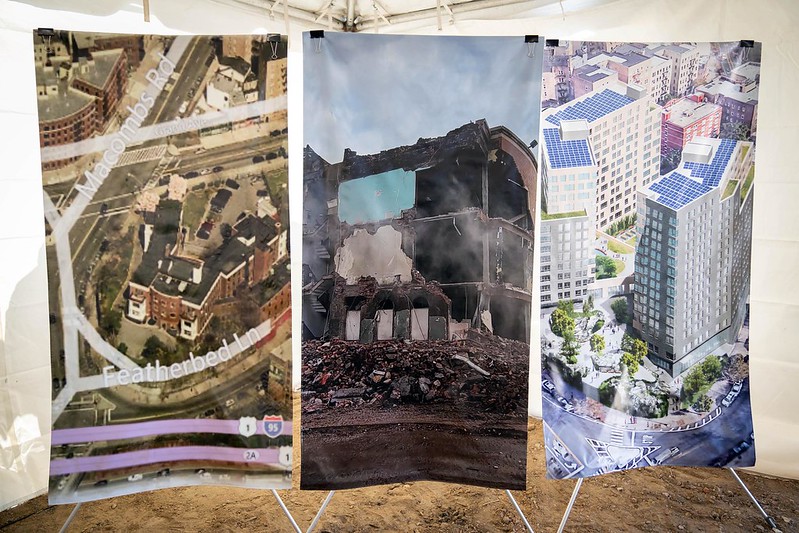
Rendering of Coney Island wetlands project (photo: mayor's office, Oct. 2013)
This is part two of a three-part series on '7 Years After Sandy.' Find part one -- Pieces In Place That Worked, Rebuilding Efforts That Failed -- here. Find part three -- Is the City's Emergency Responsiveness Ready for Whatever Comes Our Way? -- here. This series is part of Gotham Gazette's work in participation with the Covering Climate Now project, which includes over 250 media outlets focusing on climate coverage in the week leading up to the 2019 United Nations Climate Summit on September 23.
In October 2012, Hurricane Sandy killed 43 people and caused nearly $20 billion in damages and lost productivity in New York City. While the city has not seen a storm of that scale in the nearly seven years since, climate change, sea level rise, and the dangers posed by major weather events have continued to accelerate. In the aftermath of Sandy, the city began to implement a number of programs to make the city more resilient, or prepared for another Sandy-caliber disaster.
But elected officials, advocacy groups, and other experts say a Sandy-caliber storm would be nearly if not just as devastating today as it was in 2012. The city and its partners at other levels of government have been far too slow to act, and have not moved with requisite boldness in considering how to truly prepare the five boroughs, with their 520 miles of coastline, for the present and the future, they say. Projects are behind schedule or on too-long timelines, federal money isn’t being spent quickly enough by the city, there’s no real plan guiding it all.
In other words, New York City is nowhere near as resilient as it needs to be, and it’s not clear when the city might meet even a low bar for preparedness.
As the seventh anniversary of Sandy’s landfall in New York City nears, another round of evaluations, oversight hearings, and other discussions is kicking off. To many, what’s been accomplished in terms of resiliency efforts is astonishingly limited given that it’s been seven years and the lessons that were supposed to have been learned in the storm’s aftermath. Some are calling on the city to drastically speed up its implementation of resiliency projects to protect the city’s residents and their property, while a new proposal would mandate the city produce a five-borough resiliency plan.
Beyond the emergency response, the biggest questions from seven years ago remain the same today: what is actually being done to prepare New York City for the next big storm and the climate future, and what else should be done as quickly as possible?
Where Things Stand
In June 2013, the year after the storm hit, the city introduced the New York City Special Initiative for Rebuilding and Resiliency (SIRR), a $19.5 billion program to reinforce disaster protocols and prevent damage from future climate events. The initiative sought to “ensure that New York City is ready to withstand and emerge stronger from the impacts of climate change,” according to Jainey Bavishi, Director of the Mayor’s Office of Resiliency under Mayor Bill de Blasio, who took office in January 2014.
The city is especially concerned with climate change, including sea-level rise, hurricanes, extreme precipitation, heat waves, and rising temperatures, according to a spokesperson for the Mayor’s Office of Resiliency.
“Global warming is an emergency, and adapting quickly is an existential necessity,” Bavishi said in a statement to Gotham Gazette. “We’re investing $20 billion across all five boroughs to help ensure that New York City is ready to withstand and emerge stronger from the impacts of climate change.”
Many of the city’s goals are included in the OneNYC plan, a comprehensive compilation of initiatives that include strategies to improve resiliency and address climate change. By the 2050s, OneNYC estimates that the nearly 1 million residents who will live in the expanded coastal floodplain will be particularly vulnerable to coastal flooding, with sea levels expected to rise by up to 30 inches, not including the effects of major weather events. High tides will cause flooding twice a day in some areas, and permanent inundation in others, according to those projections.
Despite agreement on the urgency of the threat, the city has not executed as much as talked about its plans for resiliency, said Eric Goldstein, New York Environment Director at the Natural Resources Defense Council. The SIRR, first released post-Sandy by the Bloomberg administration in its final year, and subsequently backed by the de Blasio administration, includes more than 250 separate projects and major coastal flood protection initiatives. Its focus is five especially vulnerable areas: the Brooklyn-Queens waterfront, the east and south shores of Staten Island, South Queens, South Brooklyn, and lower Manhattan.
A good deal of work is in motion, with dozens of projects completed and others moving ahead, but at an overall pace that is surprisingly slow to many. The city has spent less than 54 percent of the $15 billion that has been funded from the city’s $20 billion SIRR, according to a May report from city Comptroller Scott Stringer.
“If another Sandy-caliber storm struck today, all roads lead to New York being completely shut down,” said Brooklyn City Council Member Justin Brannan, chair of the new Council Committee on Resiliency and Waterfronts, at City & State NY’s “Protecting New York Summit” on July 31. “My fear is that if Sandy were to happen tomorrow we’d see the same effect we saw almost seven years ago. That’s what a lot of my constituents feel as well.”
Brannan has been surveying coastal areas of the city, including those in his southern Brooklyn district, and plans to hold multiple oversight hearings this fall, he told the Max & Murphy podcast earlier in July. Brannan also discussed the fact that he and City Council Member Costa Constantinides, chair of the Committee on Environmental Protection, recently introduced a bill to mandate the mayoral administration create a five-borough resiliency plan, with certain specific guidelines.
“You’d think that, after the Rockaways, Broad Channel, and Southern Brooklyn went under water in Sandy, we’d be in better shape,” Brannan and Constantinids wrote in a recent joint op-ed discussing their bill and plans to assess post-Sandy efforts. “The 500,000 New Yorkers who live along our shores have little more than some sandbags despite scientific models showing that sea levels will rise a foot over the next 30 years.”
The city’s current efforts to become more resilient -- often called too piecemeal by Brannan, Constantinides, and others -- can be broken down into improved infrastructure, coastal defenses, and community preparedness.
On the coasts, the city has reconstructed boardwalks, built dunes across beaches on Staten Island and the Rockaways, and coordinated to place 4.2 million cubic yards of new sand on city beaches, according to a spokesperson from the Mayor’s Office of Resiliency. The city has intermittently installed flood protection measures at 40 sites, including those most impacted by Sandy, according to the spokesperson. However, these efforts are largely temporary -- they are designed to mitigate flooding until permanent measures are designed and implemented.
In lower Manhattan, the city has advanced the Lower Manhattan Coastal Resiliency Project, an approximately $500 million investment in flood-risk-reduction projects in the Two Bridges neighborhood, The Battery, and Battery Park City. The plan is expected to cover 70 percent of the lower Manhattan shoreline, according to the city’s OneNYC Plan.
For the remaining 30 percent of lower Manhattan’s shoreline, which includes the seaport and the financial district, a spokesperson for the Mayor’s Office of Resiliency told Gotham Gazette that a two-year master planning process is expected to be completed in 2021.
In terms of creating more resilient infrastructure, the city has focused efforts on upgrading building and zoning codes and investing $1 billion to improve the steam, electric, and natural gas distribution infrastructure of Con Edison facilities. In the aftermath of Sandy, Con Ed agreed to compile a report assessing the effect of the city’s changing climate on its electrical grid. The first chapter of the report (on heat and humidity) was due in 2014. Five years later, the chapter has not yet been delivered, with a new deadline set for the end of this year. And at a hearing last week discussing Con Ed’s response to summer electrical blackouts, Speaker of the City Council called Con Ed’s public response “inadequate and laughable.”
The city has also been working with federal partners, specifically emergency management (FEMA), to create a future flood risk map that can be to be incorporated into building and zoning codes.
The city has also discussed plans to extend the shoreline of the Financial District and South Street Seaport somewhere between 50 and 500 feet into the East River. Due to the current proximity of businesses to the shore, implementing land-based adaptation measures would be difficult, Bavishi said at the Protecting New York Summit, on a panel alongside Brannan.
“Any land-based protection feature would have to go deep into the neighborhood,” Bavishi said. Instead, the city is planning to build into the water.
The city will not be able to complete all of its projects without funding and relies on the federal system to receive support for many of its projects, Bavishi said at the summit.
“Funding is a challenge. We have a federal system that funds these kinds of projects in a very reactive way when we inherently want to take proactive action to address these challenges we know are coming,” Bavishi said.
“Our actions will protect Lower Manhattan into the next century. We need the federal government to stand behind cities like New York to meet this crisis head on,” de Blasio said in a March press release.
However, as the city moves ahead with efforts to fortify parts of Manhattan, many have been critical of its work to prevent flooding in the other boroughs, arguing that their risk remains as high as when Sandy hit in 2012.
“My goal with the new [resiliency and waterfronts] committee is to work with the city to make sure folks in the outer boroughs see what the city is working on in their area,” Brannan said at the City & State event. “That the city is focused on them as well, not just lower Manhattan.”
“New Yorkers deserve a mapped-out resiliency plan that protects every community — instead of a single neighborhood,” Constantinides said in a June press release announcing the five-borough resiliency plan legislation he and Brannan were introducing and referencing what some see as the over-focus on lower Manhattan.
However, city administration officials maintain that they are working equally hard to bring resiliency to the other boroughs in addition to Manhattan. Officials point to efforts to bring dunes to the Rockaways and the importation of sand to the city’s beaches. But Brannan and others pan the sand measures as something that might have made sense in 2013 or 2014, but not seven years after Sandy, when stronger and more permanent resiliency measures should either be in place or close to it.
For many of its resiliency projects, the city is working in conjunction with the U.S. Army Corps of Engineers. To date, the partnership has resulted in the construction of around five miles of new dunes across the Rockaway Peninsula.
What More Can Be Done
The city is currently working with the Army Corps of Engineers on $1 billion worth of resiliency projects, including the beginning of the construction of the Staten Island Levee in 2020, a measure expected to mitigate flood risks along 5.3 miles of Staten Island’s east shore.
In Southeast Queens, the city and the Corps are working on a plan to create a tapered groin field and “reinforced dune on Rockaway Beach combined with a system of berms, floodwalls, and nature-based features to increase resiliency for bayside communities,” according to the OneNYC Plan. The city also says it will soon begin building the Red Hook Integrated Flood Protection System, which is expected to reduce flooding in the area by installing “tiger dams” along the shoreline -- a system of plastic balloons that inflate with water and fill up to create a flood barrier as water moves inland.
In their 2013 “Sandy Success Stories” report, the Environmental Defense Fund found that wetland restoration was key in preventing serious flood damage during Superstorm Sandy. It appeared to work well in Marine Park and Dreier Offerman Park in Brooklyn, for example. However, few if any of the city’s plans include wetland restoration, and the Mayor’s Office of Resiliency did not include it alongside a litany of other projects they would be undertaking.
Among the wetland restoration recommendations in the Sandy Success Stories study are systems to choose plans for their tolerance to flooding and salt inundation, in conjunction with a slope of 1:3.
“A moderately steep slope seems to provide the most benefits in terms of supporting plant life and habitat, preventing erosion, attenuating wave action, and ensuring survival in the face of sea level rise. At the same time, this slope is shallow enough to minimize the reflection of wave energy that erodes the wetland area,” the recommendation reads.
Council Members Brannan and Constantinides are trying to look at both immediate needs and long-term planning.
“In the short term, we have to promote more green infrastructure,” the two Council members wrote in their recent op-ed. “Bioswales, which are sidewalk gardens, absorb up to 75 percent of stormwater. The Climate Mobilization Act paved the way for green roofs atop newly constructed buildings, which can retain 95 percent of rainwater dropped in summer months. And we have to make serious investments in infrastructure that might not always seem exciting, such as sewers.”
The two plan to hold a joint October City Council oversight hearing on issues faced by coastal areas of the city, post-Sandy recovery, resiliency measures, and the resiliency plan bill they are cosponsoring.
“That is a big part of this committee I’m chairing, the Committee on Resiliency and Waterfronts, where we’re going to take a really close look into what has been done and what has not been done to help make the city of New York more resilient,” Brannan said on Max & Murphy. “When we’re dealing with this thing that is literally a race against the clock, we can’t tie our own hands and sort of hold ourselves hostage to this bureaucracy of how things were done in the past.”
In his May report, Comptroller Stringer called for the city to “develop a citywide comprehensive coastal resiliency plan” while also accelerating the pace of investments into resiliency projects, and expanding a homeowner buyout program in targeted vulnerable neighborhoods, among other measures to protect the city, especially its coastal communities, from the effects of major weather events and climate change.
The citywide plan, Stringer says, “should blend data about sea level rise and other vulnerabilities from the latest science, information about the state of good repair of waterfront assets, and a deep level of community engagement and dialogue” and should be developed by the Mayor’s Office of Resiliency and other agencies, including the proposed Mayor’s Office of the Waterfront. In June of last year, Council Member Deborah Rose of Staten Island introduced a bill to create such an office, with Rose calling the waterfront “in many ways our sixth borough.”
That proposal could come up again as the Council examines post-Sandy efforts next month.
“[Constantinides] and I are looking at doing an oversight hearing in October,” Brannan said, “to really dig into the seventh anniversary of superstorm Sandy and where we’re at, what we’ve done and what we haven’t done.”
This is part two of a three-part series on '7 Years After Sandy.' Find part one -- Pieces In Place That Worked, Rebuilding Efforts That Failed -- here. Find part three -- Is the City's Emergency Responsiveness Ready for Whatever Comes Our Way? -- here. This series is part of Gotham Gazette's work in participation with the Covering Climate Now project, which includes over 250 media outlets focusing on climate coverage in the week leading up to the 2019 United Nations Climate Summit on September 23.
***
by Noah Berman, Gotham Gazette
@GothamGazette
Ben Max contributed to this story.


