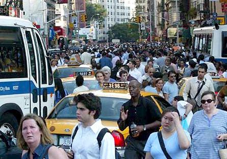
Which city in the United States added the largest number of people over the last 15 years? The answer is not Las Vegas. It's not Phoenix. It's not Dallas. It's New York City. New York City added more than 800,000 additional residents since 1990.
And, according to forecasts, this will continue. We expect that probably a million, and perhaps as many as a million and a half, additional residents will come to New York City in the next 25 years.
By then, the whole tri-state region, the already-crowded 31 counties in and around New York City, is expected to grow to 26 million people.
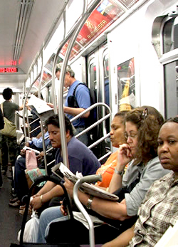
All these people will arrive in an area that is built to capacity in many ways under existing land use plans and regulations. We are already feeling ill effects of dramatic growth. Residents of parts of Queens, Brooklyn and Staten Island see every sliver of space in their neighborhoods being developed as pressure builds for taller buildings to house new residents. Our area now has by far the longest commutes in the country. And as some suburban areas pull up the drawbridge, making it very hard to construct multifamily or affordable housing, people who might choose to be in the suburbs are forced to live in the city.
Finding ways to accommodate even more residents will require public education and support. People have to understand that the city and region are going to grow, and it is either going to happen in a thoughtful way or it is in an unthoughtful way, an unplanned way.
Across the country, cities have come to realize they must join in a regional growth strategy that emphasizes public transportation, improving existing urban centers and creating new ones. Many have enlisted political, business and civic leaders as well as ordinary citizens in a dialogue about how to accommodate growth and at the same time respect the needs and fabric of existing communities. It is time for the New York region to embark upon this kind of effort.
WHAT OTHER CITIES HAVE DONE
Chicago provides a good example of how regional planning might work here. Mayor Richard Daley reached out to suburban mayors and built an alliance of elected officials from across the region to work on growth and transportation issues.
 A new group, Chicago Metropolis 2020, initiated a regional visioning process. This basically involves harnessing new technologies such as computer mapping and computer generated visual simulations so people in an area can see what the alternative futures for their communities and regions really look like. It also employs electronic town meeting techniques like we used at Listening to the City in 2003 to help shape plans for lower Manhattan.
The first step is engaging public officials and citizens to define tangible goals for their region and to set benchmarks to measure their progress. In the second step, residents develop growth scenarios. People are divided into small groups of eight or ten and sit at small tables working with maps. It is a little like playing Sim City. Each group gets chips that represent the number of people and the amount of new development that needs to be accommodated.
Usually, participants start by spreading the people and projects out in very low densities. Half an hour later, they have run out of land. That is when they come back and stack up the chips. It is kind of magical: Citizens reach the conclusion that the only way to grow is by creating a new mix of density in their region and by developing existing and new centers. When they add up the number of cars that would be generated by spread-out development, they conclude that they must have alternatives to single occupancy vehicles.
Every place that has done this has ended up focusing development in new and existing urban centers. Many have concluded that if communities with just 2 percent of the region’s land area welcome development and accept growth, they can accommodate about 80 percent of the projected growth for the entire region.
And so, in Chicago, this exercise produced a set of recommendations about transportation investments and land use changes. The usual wars about where the third airport is going to be and so forth remain – it’s still Chicago after all -- but the participants have reached real consensus about patterns of growth and the investment needed to support major growth in the region.
An even more relevant example is the Los Angeles region. Los Angeles is, if anything, larger and more complex than the New York metropolitan area. The whole area is in one state but, politically, it is thoroughly balkanized.
People from throughout the region spent about two and a half years on the visioning process, and then they spent the last two and a half years working out a way to implement it. They reached consensus on a new regional transportation plan with a network of truck-only toll lanes on major freeways and of high occupancy toll lanes in key corridors. And they have agreed on a set of transportation investments across the region.
They also adopted some land use changes. The city of Ontario, California, which is an older industrial city with an eroding manufacturing base, decided it could accommodate a substantial amount of growth. They agreed to adopt zoning changes to allow for more residents, and the region agreed to make investments around Ontario’s airport and in a new regional downtown that will double the city’s population. When this is done, Ontario will have almost half a million people, a major new employment center and new housing.
Other cities in the region said they could not accept 30 or 40 housing units per acre, but they were willing to see what 20 would look like. And so they ended up with former industrial areas and strips being rezoned for mixed use, mixed income development.
Los Angeles is expected to grow from 18 million to 22 million people over the next 25 years. The New York region is going from 22 million to 26 million, so we need to think about following Los Angeles’ example.
SPACES IN THE CITY

Bensonhurst, Brooklyn
Finding space for all the additional people arriving in New York City will be hard because we have built on the easily developed vacant sites.
Throughout the city, people do not want additional development or additional density.
But there are still plenty of places to develop. The city has begun the process of rezoning in Greenpoint/Williamsburg, the Far West Side and so forth to prepare for additional population and employment growth. We have got a network of what the Regional Plan Association calls regional centers, places like Jamaica, Flushing, downtown Brooklyn and the Bronx Center. All of these have the potential to accommodate some additional development. And in the suburbs, areas such as the Nassau hub and Hicksville could be developed to house more people and jobs.
Queens, which is projected to add about a half million additional residents over the next 25 years, will have to accommodate more growth than any other place in the region. It has a lot of areas along the avenues currently dotted with one-story commercial buildings. Those plots could be recycled and more intensively developed. And we have the potential to expand Long Island Rail Road service in large areas of Queens that do not have subway service. Doing that would create some new development opportunities without adding to congestion.
If we can harness population growth and reinvest in existing and new urban centers we can improve mobility, create better development patterns in the region and heighten the economic prospects for our citizens.
For an example of why we should do this, we can look to Orange County, California. Twenty-five years ago, it was a very conservative place. It said, “We really don’t want a lot of immigrants and â€those people’ coming here.” They adopted a number of “pull up the drawbridge” zoning and housing regulations to prevent multifamily housing. They did not accommodate growth. But growth came anyway. People doubled and tripled and quadrupled up in single-family houses. This caused serious housing safety problems and other dilemma.
So planning for growth is essential. But the city cannot go it alone. Both New York City and its suburbs are in the same boat, and it will take collaborative action to keep as all afloat.
REGIONAL PLANNING IN NEW YORK
We have a number of assets to work with.
Demographic Changes: The baby boomers are aging, their kids are out of the house, and many are deciding to chuck the keys to those suburban houses and move into New York City and or another of the region’s older urban centers. At the same time, crime rates in the city have dropped, making the city a more attractive place to live.
Transportation: Over the last 25 years, we have invested more than $50 billion in the transit system. That has created a safer and more reliable transportation system in the core of the region.
We also have the largest regional rail system in the world. And in many ways the commuter rail system is not as intensively used as its counterparts in London, Tokyo, Paris and other world cities. There are many places where the density of development within walking distance of a station is relatively low. And so we have enormous potential to fill in development around this system.
To promote that, we have several very large transportation projects that are now partially funded, have full funding agreements with the federal government or are expected to get them. These include the East Side access project and the Second Avenue subway. The ARC project, including a new Hudson River tunnel, is coming along just behind them, and the rail link between lower Manhattan and Kennedy airport has partial commitment of state and federal funds and Port Authority funds. None of these projects, however, can fulfill its potential unless we coordinate land use and transportation around them.
Planning: Our area has strong public agencies, as well as regional organization such as the Regional Plan Association and the New York Metropolitan Transportation Council. This tri-state area also has a track record of successful visioning exercises, such as Listening to New York, at the sub-regional and local level
But there are obstacles as well.
We have one region as far as the business community and commuters are concerned. But unfortunately, King Charles II decided it would be convenient to make the Hudson River the boundary between the province of New York and the province of New Jersey. The province of Connecticut was just 30 miles away. Like plate tectonics, these three places that don’t really like each other rub up closely against each other. To make matters worse, we have 31 counties, and things get really messy when you drop in the political subdivisions: towns, villages, small cities, boroughs, unincorporated areas and so on. We are the most politically balkanized metropolitan region in the country. This makes reaching consensus on the major land use and transportation investment policies and investments a lot more difficult than it would otherwise be.
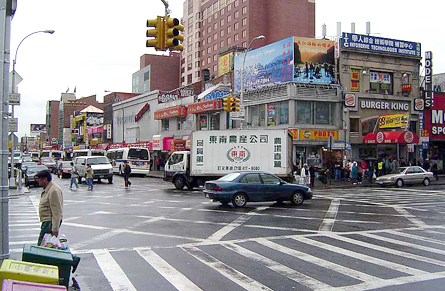
Flushing, Queens
And then there is history. Robert Wagner was probably the last mayor of New York City to reach out beyond the city’s borders. Through much of the last 25 or 30 years, New York City felt like the region is a zero sum game: If Nassau or the Jersey waterfront grew, city officials thought, it was at the city’s expense.
But that may finally be changing. I think Mayor Michael Bloomberg -- maybe partly because he ran a company that has operations in New York and New Jersey -- understands that we live in a region with an integrated economy. And the city has been doing really well of late, so there is a growing realization that there’s plenty of development and growth to go around. We are not managing decline here, we are managing success -- and that makes it easier to reach across the political boundaries.
As part of this whole regional planning process, we must build a broad base of political support around tough things: Finding the money to pay for the next generation of transportation investments. Making difficult land use decisions. Promoting growth.
Doing this right can produce many benefits. We can conserve the environment, create a mix of housing types and densities, and get the governance and tax reforms to make this work. It is hard to reach consensus around anything in this big messy place that we call home, but we must do it.
Robert Yaro is president of the Regional Plan Association.
Â

